Sometimes, for example, when going on a hike, it is extremely important for us to know the times of sunrise and sunset. I would like to find myself in civilized places before dark. But how do we calculate when to leave and when to return? Easy! Take a look at the tear-off calendar. There, for each day, it is indicated exactly to the minute when the sun rises and when it sets. Add to this another half an hour or an hour (depending on the distance from the equator and clear / cloudy weather) for morning dawn and evening twilight, and you will get the length of daylight hours.
However, in this advice - to be guided by a tear-off calendar - there is one but. So we will know the time of sunrise and sunset, for example, in Moscow, but by no means in our area. And here we have to move from lyrics to dry language of numbers. Ready? Then read our article and calculate the daylight hours for your area.
What geographic parameters are involved in the calculation
In relation to our star, planet Earth rotates at a speed of fifteen degrees per hour. The Sun occupies its highest position in the sky at noon. And in this paragraph, one should take into account an amendment for possible summer time, when the chronometers of many countries arbitrarily (that is, without agreement with the Cosmos) are set one hour ahead. Then the sun is at its zenith at 1 pm. But that's not all.
There is also the concept of "true noon". The earth is divided into time zones. Each of them is a rather vast territory. Therefore, in settlements located to the east or west of the hour meridian (where noon occurs at exactly 12:00), it is observed earlier or later. Thus, it is necessary to establish the longitude at which the settlement of interest is located. To determine sunrise / sunset, we also need to know the latitude of the area relative to the equator.

The magical dates of the equinox and solstice
Twice a year, the Earth turns to our star at an angle of 90 degrees. This year it will happen on March 19 and September 22. On these days, anywhere in the world, sunrise and sunset will occur at six o'clock (morning and evening, respectively). That's when it comes to calculating local time! In the north, dusk and dawn play for a long time in the firmament. In tropical latitudes, the sun dives quickly below the horizon. But this is not the main thing. After all, daylight hours may optically become less due to simple cloudiness.
There are two more dates to remember: winter and summer solstice. For the northern hemisphere, December 21 is the day with the longest night. And on June 21, the sun is in no hurry to leave the firmament. On this date, night does not fall on the Arctic Circle, and December 21 is not replaced by day. But when does dawn come at the summer and winter solstice in the area of \u200b\u200binterest to us?

Sunrise and sunset in Moscow
Let's consider an algorithm for calculating the duration of daylight hours and, therefore, the time of sunrise and sunset using the example of the capital. On the 19th of March in Moscow, however, as elsewhere in the world, it will be light at twelve o'clock. But since the metropolis is located just east of the UTC +3 hour meridian, the sun will rise there not at 6:00, but at 6:38. And it will also come in at 18:38. Daylight hours continue to increase, reaching its climax at seventeen hours and twenty-five minutes on June 20. We can easily determine the sunrise and sunset for Moscow on this date. Noon occurs there at 12:38 pm. Then it turns out that the sun rises at 3:48, and sets at 21:13. Do you already know the deviation from the hour meridian in your village? When is true noon there?

Sunrise and sunset at the selected location
Equinox and solstice dates can be the starting point for calculations. On March 20, both at the Arctic Circle and at the equator, the sun will rise at 6:00, and the sunset will be at 18:00. Here we take into account the deviation from the hour meridian. After the vernal equinox in the Northern Hemisphere, daylight hours begin to increase, reaching its apogee on June 21. In the Arctic Circle, sunrise and sunset occurs at 0:00. Therefore, daylight hours lasts twenty-four hours. And at the equator everything remains the same: sunrise at 6:00, sunset at 18:00. The higher the latitude, the longer daylight hours increase, the earlier the sun rises and the later it sets.
Knowing the geographical coordinates of the point, it is easy to calculate the time of sunrise and sunset. We derive the formula. Find out how many days are between the vernal equinox and the summer solstice. Ninety-two days. We also know how many hours of daylight hours on the summer solstice. Let's say eighteen hours. 18 - 12 \u003d 6. Six hours divided by 92. The result is how many minutes each daylight grows. We divide it by two. This is how much earlier the sun rises compared to yesterday.
"Ras-light! For-ka-you!"(c) Zemfira
"As you "re staring at the sun"(c) Dexter Holland
Today the site of the day is the SunCalc service, which displays astronomical information about the Sun on Google maps.
SunCalc logo
SunCalc logo
SunCalc is not only a fun timekiller for geography fans, but also a great example of what educational materials can be in the Internet age. The SunCalc website is another reason to remind the employees of the Ministry of Education that we live in an era of different speeds, different technologies and a different level of demand for information, so a pathetic little book with a boring description of the most boring theses of the subject can no longer claim the proud title of "Textbook" ... It's easy to imagine what the textbook of the future could become if the SunCalc website is just one illustration for one of the lessons. Obviously, there is a lot of work to be done, but you have to start somewhere, and SunCalc is one of those "undertakings".
On the SunCalc website, you can set a location on the map and a virtual sky circle will be drawn for it. An orange arc will mark the path the Sun travels across the sky today (except during polar night). Light yellow will be painted over a part of the sky, on which the Sun at least sometime happens. Colored radii will show the direction of the sun at dawn, dusk and right now (if not night). You can use the real Sun instead of a compass, or you can find the exact position of the Sun in the sky even on the most cloudy day. In parallel, tabular data will be displayed with the time of the onset of the phases of the day, including three stages of twilight.
Chart for Moscow on the SunCalc website
The best part starts when you compare the indicators for different points on the map. The data from the textbook begins to play with new colors. You can see white nights, polar days, equinoxes, solstices and other phenomena from the life of the Sun on the diagrams. You can feel the lines of the tropics and the equator (in the tropics, the border of the yellow zone will pass through the center of the circle, and at the equator there will be a wide, strictly horizontal yellow stripe). In general, you can stop stressing, presenting the data from the textbook in your head, and just see it on the monitor in an extremely visual form.
Those who have not read the textbook yet (or have read it, but have forgotten) can simply see what is happening with the Sun there in the world with the Sun on the SunCalc website, and sooner or later become interested in why it wants to delve into the textbook. It seems to me that this is the easiest way to get people interested in studying, but maybe I'm wrong and boring teachers have better methods.
Here, look, there is so much Sun in Rio, not what we have.
SunCalc shows on the map for the selected location and date the trajectory of the sun and the phase of illumination during the day (and a couple of other pleasant things).
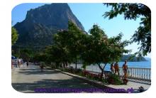
The idea for it came after I needed to find a good place in Crimea to shoot a frame of the sun going into the sea at sunset (for the video, they filmed it in the end) - it turned out that all the existing means for this were very outdated. I wanted to create my own, making it the best you can imagine, found a good page with a bunch of astronomical formulas, took up development on free evenings and here's the result.
Opportunities
- draws a beautiful vector graph on the map with the position of the sun at sunrise, sunset and at a selected time (yellow, orange and red line), the projection of the sun's trajectory (orange arc) and its spread throughout the year (yellow area around it); the closer the point on the graph is to the center of the circle, the higher at that moment the sun is above the horizon
- by hovering the mouse over the dawn / dawn line shows the corresponding spread of positions
- shows illumination (darkness, twilight, daylight) in color on the time slider
- you can see the time not only of sunrise and sunset, but also of 3 types of twilight (civil, navigational, astronomical) and complete darkness
- shows a link to the weekly weather forecast (cloudiness, precipitation, fog) in the selected location
- knows how to determine the location (click on the corresponding field -\u003e Detect my location)
- location can also be selected by search, autodetection, clicking on the map or dragging the marker
- work permalinks to a specific place / time and back / forward in the browser
What the ego can be used for
First, in purely everyday situations. Until what time do I need to leave the forest, while at least something is still visible, if I still have not bought a headlight for a bike? Until when can I sunbathe in the evening before the beach is shaded by the rock on the right? What time will the sun not dazzle directly in your eyes when I go out to play football on the ground under the house? What is the illumination of the apartment I am going to rent during the year? It has already come in handy more than once in such matters.Secondly, for photography lovers! Including me. It is often important to know, for example, when and how long twilight lasts (for night landscapes), in which direction the sun sets or from where it rises (to choose a good angle), what time to choose for a photo session of an object so that you do not have to photograph against the sun or it did not fall completely into the shadow of a neighboring building, etc.
Third, for general education and the satisfaction of natural curiosity. Why is Australia hotter in winter than in summer? What really are white nights and in which cities and when are they observed? What about polar day and night? How does the trajectory of the sun change from north to south? How many minutes does dawn travel from Moscow to Kiev? Etc.
Few implementation details
- all application code is executed on the browser side
- google Maps API v3 is used for maps and search
- for vector graphics on the map - Raphaël library
- for location -, Google Gears or Google IP Geolocation
- uses jQuery and several jQuery UI components (Slider for time, Datepicker for date, and Dialog for welcome window)
- for deep linking and ajax history the plugin is used here. Thanks!
update: sorry for the problems with hosting, the project has temporarily moved to another server - now everything seems to be fine.


Naruto storm 4 sees gamepad
Now on the map: how the new Yandex
Radar Data Maps Radar Observation Map
Where is Mexico - detailed map of the world with cities in Russian Geographic map of Mexico
Organization of game processes in a multiplayer game Entering another level in a computer game