Name: Military topography.
In this textbook sets out a course of military topography, the knowledge of which is necessary for each officer
The first section of the textbook discusses the classification, the mathematical basis and the geometric essence of topographic maps, their content, the method of reading and measurement on them. Here are also considered properties of aerospaces, the basics of their military decryption and the rules of their use in solving combat missions
The second section is devoted to the locality orienteer in various ways, including with the help of navigation equipment
In the third section, in relation to the practical activities of the divisions commanders, the use of maps to study the area, evaluating its tactical properties, management of troops and target designation in various types of battle, as well as the preparation of combat schedule documents, procedure and methods of conducting exploration of the locality
The appendix gives samples of topographic maps, conventional signs, various types of aestrons.
The area is one of the main and permanent factors of the combat situation that significantly affects the combat activity of troops. The peculiarities of the area affecting the organization, the fight and the use of military equipment are called its tactical properties. The main of these includes its permeability and conditions of orientation, disguise and protective properties, the conditions of observation and maintenance of fire.
The skillful use of the tactical properties of the terrain contributes to the most efficient use of weapons and military equipment, maneuver secrets and suddenness of strikes on the enemy, disguise from observation and protection of troops from the enemy fire. Consequently, when performing combat missions, each soldier should be able to quickly and correctly study the terrain and evaluate its tactical properties.
Content
Introduction
§ 1. Subject, content, tasks and method of military topography
§ 2 Place and role of military topography in the system of combat training of troops
Section First
Topographic Maps and Aerospace, MyPrenimenneys Troops
Chapter 1. Classification, Purpose and Geometric Card Essence
§ 3. The main types of cards
1. FelingCartiographic image
2. Emphades, special cards
3. Classification Purpose of topographic maps
§ 4. Mathematical foundation of constructing cards
1.Gometric essence of the cartographic image
2. Document in cartographic projections
3. Suggescent networks
§ 5. Projections of Soviet topographic maps
1. Setting cards 1:25 000-1: 500 000
2. Carecase Map 1: 1000000
§ b. Demand and the nomenclature of topographic maps
1. Card Demands System
2. Namerenclature of sheets of cards
3. Selecting and extracting the number of sheets of cards to the desired area.
Chapter 2. Measurements on the map
§ 7. Measurement of distances and squares
1. Map cards
2. measuring lines on the map
3 Accuracy Measurement Distance on the map
4.Poppers within the distance for the tilt and the lines of lines
5. For example methods of measuring the area on the map
§ 8. Determination by the map of the coordinates of the points of terrain and objects (purposes)
1. Systemicordians used in topography
2. Determination of geographic coordinates
3. Definition of rectangular coordinates
§ 9. Measurement on the map of directive angles and azimuths
1.Azimuts and directory angles
2. Measurement and construction of directory angles on the map
3. Transport from the directory angle to the magnetic azimuth and back
Chapter 3. Reading topographic maps
§ 10. System of symbols on maps
1. Power and details of the area
2. Prices of construction and application on the conventional signs
3 failed signs
4. Color (color) cards
5. Digitious signatures and digital designations
6. General Card Reading Rules
§eleven. Image of relief on maps
1. Ultypes and elementary relief forms
2. Surprise image relief horizontals
3. Wides horizontals
4 image horizontal elementary relief shapes
4. Spleens of the image horizontals of flat and mountain relief
6. Significant signs of elements of relief not expressed by horizontals
Features of the relief image on the maps of scale 1: 500,000 and 1: 1000 000
§ 12. Study of the relief on the map
1. Heating the structure and elementary form of relief
2. Determination of absolute heights and mutual extest points of terrain
3. Determination of raises and descents
4. Determination of shape and steepness of the skates
§ 13. Image on the maps of water bodies
1. Refractory strips and coast of seas, large lakes and rivers
2. Overlook, reservoirs and other reservoirs
3., Channels Other Objects of River Systems
4. Forms and other sources of water
5. Additional data on water bodies contained in the references on the area on the map of scale 1: 200 000
§ 14. Image of vegetable cover and soil
1. Invoice elemental cover
2.Wed-soil
§ 15. Picture of settlements, industrial enterprises and socio-cultural facilities
1. Named items
2. Industrial and agricultural manufacturing enterprises and structures
3. Communication, electrolyneys, pipelines, airfields and socio-cultural objects
§ 16. Image of the road network
1. Rhine expensive
2. Horses and ground roads
§ 17. Borders and geodesic items
1.Rans and fences
2.GeezesophunctsTeaten items - Landmarks
Chapter 4. Area Aeros
§ 18. Types and properties of aerospaces
1. Eurmers as reconnaissance and measuring documents
2. Wides of aerospace
3 Use of aerospace in the troops
4.Gometric essence of aerospace
5. Aims on the distortions on aerial skins
6. The insignificant properties of aerospace
7. The effect of photocouples
§ 19. Preparation of aerosries to work
1. Anesthesia Aerospaces to the map
2. Determination of the scale of the planned aerospace
3. Magnetic Meridian directions on aerospace
4. Confirmed on the preparation for the work and use of promising aerospaces
§ 20. Measures for aerial windows
1. Properness to work with aerial windows
2.Seskopic (Volume) Consider aerospace
3. Determination of distances and sizes of aerospace objects
4. Pointed aerospace on the map
5. Determination of POWEROGALLOBOCINATES
§ 21. Aerospace decryption
1. Temporable (decoding) signs
2. Confreection of aerospace
3. Support and completeness of aerospace decryption
4.Made-free object
5. Confirmed on the decryption of tactical objects
Section two
Orientation on the terrain
Chapter 5. Orientation on the map and aerospace
§ 22. Essence of orientation
§ 23. Determination of distances when oriented on terrain and targeting
1.Laber
2. Determination of distances for measured angular sizes of objects
3. Determination of the distance on the speedometer
4. Power steps
5. Determination of traffic time
§ 24. Devices and methods for determining directions and measurement of corners on the ground
1. Magnetic compass and its application
2.Gipopolum and its use
3. Measurement on the terrain of horizontal angles
4. Definition and maintenance of the direction of traffic on the celestial luminaires
§ 25. Receptions of orientation on the map (Aerospace)
1. Map relocation
2. Determination on the map (aerospace) of its location
3. Card with terrain
§ 26. Orientation on the map in motion according to the specified route
1. Preparation to orientation
2. Orientation on the way
3. Orientation in motion in various conditions
4. Installation of lost orientation
§ 27. Azimuth movement
1. Preparation of data for azimuth movement
2. Azimuth Movement
3. Communication obstacles
4.And the return path
5. Movement of the Azimuts
§ 2s. Responsibilities of commander of units to ensure orientation and target design on the battlefield
1. Selection and use of landmarks
2 Orientation on the terrain of commanders of subordinate and supporting units
3. Events that provide orientation in the actions at night and on the terrain, poor landmarks
Chapter 6. Orientation on the area using ground navigation equipment
§ 29. Principle of operation and basic instruments of navigation equipment
1. The principle of determining the current coordinates of the moving machine
2. Home appliances navigation equipment
3. The accuracy of the location of the machine
§ 30. Orientation preparation
1. Matching and launching equipment
2. Balance of the gyroscope Codecode
3. Clearing the vehicle of the machine
4. Estimation of the route of movement and preparation of the map
5. Preparation of the source data
6. Installation of coordinates and directory angle
§ 31. Orientation on the terrain with the help of the coordinator
§ 32. Features of preparation for the work and operation of the codecaster
R Azel Third
Using cards and aerospace commanders of units
Chapter 7. Map as a means of management
§ 33. Preparation of a card to work
1.Obonizhenies card
2. Clipping card
3. Waying the card
4. Map lining
§ 34. Basic rules for maintaining and using a working card
1. Basic rules for applying the work card
2. Using the card with reports, setting the problem of compiling combat documents
§ 35. Application receptions on the card of elements of their combat order and goals
1. Determination of landmarks and goals and applying them to the map
2. On the map of the elements of their combat order
3. Determination on the ground and deposition of invisibility fields
§ 36. Carecania on the map and aerospace
1.The set design in rectangular coordinates
2.The showproofs of the kilometer's dealers
3.The setting from the conditional line
4. Moldation from the nearest landmarks and contours depicted on the map
5.TrappingOPA Azimut and Distance Diauctions
6.The sets of aerospace
Chapter 8. Learning the locality by the commander of the division
§ 37. General rules for studying the assessment of the area
§ 38. Definition of general terrain
§ 39. Study of the conditions of observation and masking properties of the terrain
1. Determination on the map of mutual visibility points
2. Determination and application on the map of invisibility fields
3. The construction of the terrain profile map
4. The significance of the curvature of the Earth and atmospheric refractive for observation range
§ 40 Study of terrain conditions
1. Heating road network
2. The treatment of terrain outside roads
3. The extensions about the effect of terrain of terrain to perform a combat
§ 41. Study of the protective properties of the area
1. Heating the protective properties of the relief
2. Increased protective properties of the forest and the nature of soils and soils
3. The extensions about the effect of protective properties of the area to perform a combat mission
§ 42. Study of fire conditions
1. Determination of shelter depth
2. Determination of the corner of the shelter
3. Determined the place of the goal
§ 43. The concept of forecasting the locality in the area of \u200b\u200bthe nuclear explosion
1. Determination of the degree of destruction of terrain and heat meters
2. Opportunity on the map of forecasting results
§ 44. Expansion and assessment of terrain on the map commander
motorized rifle platoon appointed to the head hiking
§ 45. An example of studying and evaluating the "locality by a motorized rifle company commander when an opponent's immediate contact
Chapter 9. Exploration of the Area
§ 46. Methods of exploration of locality
1. Related
2. Watching the terrain by the disorns
3. Subject
§ 47. Route intelligence
§ 46. Intelligence of individual terrain facilities
1.Reveloped
2. Condemble swamp
3. River occupation
4. The concept of the exploration of location changes in the center of the nuclear explosion
§ 49. Graphic documents with intelligence information
1. Graphic accounting of reconnaissance information in units
2.Vides combat graphic documents
3. Estimated the drawing of combat graphic documents
4. The draws of the preparation of location circuits on a map or aerospace
Applications:
1. A list of abbreviated signatures applied on topographic maps
II. Some approximate accountability data of terrain
III. Making layout on the ground
IV. Answers to examples and tasks
Alphabetically substantial indicator
V. Samples of the Topographic Cards of the USSR
Vi. Image on maps of some species of flat, hilly and mountainous terrain
VII. Tables of conditional signs of topographic maps
VIII. Scale clippings 1: 50 000 and 1: 100 000
IX. Samples of aerospace for decifreaming
Military topography
Military topography is a science that makes it possible to develop ways and means for obtaining information about various locality in the interests of combat activities.
The purpose of the use of topography
When applying a completely, powerful gun and radio equipment, it is required to produce accurate topped-proof measurements and calculations on the estimated direction of further actions, as well as determining the distance of their goal. As a rule, such guns have no small distance to defeat the target, therefore requires the maximum measurement accuracy. But success in battle may require the most maximal, but accurate solutions to the use of measuring equipment. But it is also important that every member of the detachment had a good eye and could quickly navigate and find a way to measure the distance to the target and other objects.
Simple measurement techniques
Simple linear and angular dimensions have demand for exploration and land orientation, as well as for firing source data. The eye meter is the easiest way to measure, it is available to each military service and applied in any conditions. Also, field binoculars are used to measure, in the field of view of binoculars there is two tall scales for measuring vertical and horizontal angles. If the presence of binoculars is absent, then you can use the usual line, but you need to have certain skills. Instead of a ruler, you can use undergraduate items such as:
palm
finger
matchbox
pencil
Also, not a replace assistant is a compass that helps to navigate, at the right track direction. Another non-replace assistant becomes a map that have many values \u200b\u200band have several varieties.
reference Information
Azimuts and directory angle. Magnetic declination, rapprochement of meridians and correction Selection of landmarks. Target designation, azimuth and range to goal, guidance of weapons in the goal Holding the specified (intended) direction of movement and distance. Bypassing obstacles Performance of the standard: "Movement in azimuths within walking order" Performance of the standard: "map orientation" Performing regulations on military topography: 1.3, 5-10 Performance of standards: "Determination of the direction (azimuth on the ground)" and "Measurement of distances (angles) on the ground with a binoculars (line with millimeter divisions)" Performing standards: "Reading card" Measurement and construction of directory corners on the map. Transition from the directory angle to magnetic azimuth and back Measurement of distances on the map. Study of the area. Reading a map on the route Measurement of corners and distances on the ground Image and reading of local items on maps: hydrography, plant cover and soil, settlements, industrial enterprises and socio-cultural facilities, road networks and individual landmarks Study of the tactical properties of the terrain: the conditions of observation and masking properties of the area (determination of the mutual visibility of points), the conditions of passability, protective properties of the area Linear and angular units of measurements Map scale The terrain as an element of the operational combat situation. Definition on the general area of \u200b\u200bterrain Bypassing obstacles. Finding the return path Acquaintance with the map (map score), clarification, the height of the section, year of shooting and reconnaissance, year of publication, direction amendment, digitizing the coordinate grid Definition of azimuth on local items Determination of geographic coordinates and application of objects on the famous coordinates Determination on the map of absolute heights and relative extest points of the terrain, lifts and descents, rolling rods Determination of directions on the side of the horizon on the compass, celestial luminaires, signs of local items Determination of the position of objects (points) in the systems of polar and bipolar coordinates, applying to the object of objects in the direction and distance, on two corners or two distances Definition of rectangular points coordinates. Application on the card points according to their coordinates Determination of the side of the horizon, magnetic azimuths, horizontal angles and direction of movement by compass Determination of the nature of local items on the images on the maps Orientation on the area without a map. Determining your location relative to the local items. Holding the direction of movement on celestial luminaires, local subjects specified by azimuts Orientation on the area without a map. Essence of orientation Orientation on terrain on azimuths. Magnetic azimuth. Definition of azimuth on local items Orienteering on the map on the map (Scheme): Methods of orientation of the card (Schemes), the order of identification of landmarks, the definition of its location, card sharing (scheme) with a terrain Orientation on the area on the map of commanders of subordinate divisions and other persons Orientation on the area on the map. Orientation of a map in directions on the side of the horizon, on the guidelines, according to a linear guideline. Recognition of landmarks Orientation using the hypoloompace. Orientation of a card in the car. Exit Basic rules for maintaining a working card. Lifting card. Conditional signs and abbreviations used when conducting a working card and draw up other graphic documents. The main elements of the content of the map. Large-scale, ease and explanatory symbols. Card design. General Rules for reading topographic maps Features of locality orientation in limited visibility Preparation of data for azimuth movement The concept of service graphics documents, their appointment and content Sequence and main issues of studying and evaluating the area when planning and conducting operational combat operations and performing special tasks Rectangular coordinate grid on topographic maps and its digitization. Additional mesh at the joint of the coordinate zones
Topic number 2.
Basics of military topographyLesson number 1
Topographic maps and reading them Curriculum
№
P / P.
1.
2.
3.
4.
Questions
The essence of topographic area of \u200b\u200bthe area.
Mathematical and geodesic base of cards.
Demand and the nomenclature of topographic maps.
Definition of the nomenclature of adjacent sheets.
Classification of topographic elements
terrain.
Study and evaluation of elements of terrain on the map.
Determination of their quantitative and high-quality
Characteristics.
Training goals
Clarify students essence imageterrain on topographic maps and
Classification of topographic elements
terrain.
Calculate the order of separation and nomenclature
topographic cards, definition
The nomenclature of adjacent sheets.
Literature
"Military topography."
M., Military Publishing, 2010
p. 9-26, 35-38, 47-53, 60-64, 150-161.
For additional study: p. 26-34, 38-47,
53-59.
1. The essence of topographic image of the area. Mathematical and geodesic base of cards.
Military topography(from the Greek Topos - the area, GRAPHY - I write)
- Special military discipline about ways and
Means for studying and evaluating terrain,
Orientation on it and the production of field
measurements to ensure combat
activities of troops (forces), about the rules of reference
Working cards commanders and development
Graphic combat documents.
Geometric essence of the image of the earth's surface on the map.
Geographical position of pointsThe earth's surface is determined by their
coordinates. therefore
Mathematical task of construction
cartographic image
lies in the design on
Plane (map) Sharo-shaped
ground surface with strict
Compliance is unambiguous
Conformity between coordinates
Points on the earth's surface and
The coordinates of their image on
card. Such design requires
Knowledge of the shape and size of the Earth.
The dimensions of the earth's ellipsoid at different times were determined by many scientists on the materials of degree dimensions.
By definitionCountry, where
Published
Definitions
Year
Big
Definitions semi
Bessel
Germany
1841
6 377 397
1:299,2
Clark
England
1880
6 378 249
1:293,5
Heoford
USA
1910
6 378 388
1:297,0
Krasovsky
the USSR
1940
6 378 245
1:298,3
Compression
Horizontal run
As an image of the physical surface of the earth on the map (plane) of itFirst, we design with the sheer lines on the level surface, and then
Already on certain rules, this image is deployed on
plane.
In fig. horizontal injection (image in terms of) dots, straight,
broken and curve lines
The image in terms of points and lines of the earth's surface is called them.
horizontal injections or horizontal projection.
Cartographic projections
The set of elements andterrain objects and reported about them
Information is called
Card content.
The essential features of the card are:
clarity
Measpety I.
High informativeness. Visuality card opportunity
perception of spatial forms, sizes and
Placement of depicted objects.
Measpericness - an important card property, closely
associated with the mathematical basis, provides
Ability to accurately allowed
maps, determine the coordinates, sizes and
Placing object objects, use cards
When developing and conducting various events
national economic and defense significance
solving scientific and technical tasks
The measurement of the card is characterized by the degree
matching the location of the points on the map of them
location on mapped surface.
The information card is its ability
contain information about the depicted objects or
phenomena. Displaying the surface of the ellipsoid or ball on the plane
called cartographic projection. Exist
Different types of cartographic projections. Each of them
Corresponds to a certain cartographic grid and inherent
It is distortion (squares, corners and lengths of lines).
Cartographic projections classify:
- by character distortion,
Image of the images of meridians and parallels
(geographic grid),
- by orientation relative to the axis of rotation of the globe and
Some other features.
In the nature of the distortion distinguish the following
Cartographic projections:
- Equifricular - preserving the equality of angles between
directions on the map and in nature;
In fig. World Map B.
Equifricular projection - Isometric - preserving the proportionality of the area
On the map of the corresponding squares on the Earth Ellipsoid.
Mutual perpendicularity of meridians and parallels on such
The map is stored only by medium meridian;
In fig. World Map B.
Isometric projection
- Equipment - Saving consistent scale
at any direction;
- arbitrary - not preserving their equality of angles, nor
Proportionality of space, no consistency. Meaning
Applications of arbitrary projections is more
uniform distribution of distortion on the map and convenience
Solving some practical tasks.
The content of topographic maps must be: full, reliable, modern and accurate.
Completeness of the content of the card means that on themMust be depicted all typical features and
Characteristic topographic elements reflecting in
First of all B.
accordance with the scale of the map and its purpose.
Accuracy (correct information
depicted on the map at a certain time) and
Modernity (compliance with the current state
The displayed object) Maps mean that the content
Cards must be in full compliance with
Terrain at the time of use of the card.
Card accuracy (degree of conformity
location points on the map of their location in
reality) means that those depicted on it
topographic elements of terrain should save
accuracy of its location, geometric
similarity and sizes according to the scale of the map and
Its appointment.
As the main scale of topographic maps taken: 1:25,000, 1:50 000, 1: 100,000, 1: 200,000, 1: 500,000 and 1: 1 000 000.
Scale map 1:25 000 (in 1 cm - 250m); 1:50 000 (in 1 cm - 500m) andMap of scale 1: i00 000 (in 1 cm - 1km) are intended for study
terrain and evaluation of its tactical properties when planning combat,
Organization of interaction and management of troops, orientation on
terrain and targeting, topogeodesic binding elements of combat
orders of troops, determining the coordinates of objects (goals) of the enemy, and
As well as the 1: 25000 scale map are used in design.
Military Engineering Constructions and Measures
Engineering terrain equipment.
Map 1: 200 000 (in 1 cm - 2km) is intended for study and
terrain estimates when planning the fighting troops and
Events for their provision, management of troops.
Map of scale 1: 500,000 (in 1 cm - 5km) is intended for study and
Assessment of the general nature of the area in preparing and conducting operations.
It is used when organizing interaction and management
troops, for orientation when moving troops (in flight) and
Camescript, as well as for applying a common combat situation.
Scale map I: I 000 000 (in 1 cm - 10km) is intended for general
Estimates of the terrain and study of natural conditions of districts, TVD,
Management of troops and solving other tasks. City plans
Create on the territory of cities,
large railway units, naval databases and other important inhabited
Points to their surroundings. They are
Designed for a detailed study
cities and approaches to them
Orientation, accurate
measurements and calculations with the organization and
Maintain battle.
Flight (Mashedral Flight) Cards
included in the mandatory set of flyer equipment and
Navigator and are basic for navigation purposes. On the
flight maps is performed the main amount of work when
Preparation and directly during the flight itself. For
preparation for flight on maps is paired and placed
The route is selected and test references and
Rotary points for monitoring the path.
Flight and route-flight cards are
Basic for purposes
Navigation: Visual
and radar
masking, as well as for
Execution
necessary measurements I.
Graphic constructions for
Flight Control. Air navigation and topographic maps
Onboard maps
Designed to navigate in cases where
the aircraft is forced to go beyond the flight card, and
Such for processing navigation measurements obtained from
using radio engineering and astronomical agents
navigation.
Cards of the area of \u200b\u200bgoals
- These are large-scale cards from 1: 25000 to 1: 200000
In the projection Gauss. These cards are used to calculate and
definitions of the coordinates of the specified objects for
Orientation, target designation and detection of small-sized
objects on the ground. Air navigation and topographic maps
Special maps
Used when solving automated tasks
withdrawal of aircraft on the terrestrial goals of their target designation and
flight management and are designed to solve
navigation tasks according to measurements received from
using radio equipment. These include cards
various scales and projections on which lines are applied
provisions.
It should be borne in mind that special and board cards can
Combine.
Reference cards
Designed for various references required
When planning and preparing for flights. These include
Maps of large airfield nodes, review navigation
Maps, magnetic decline cards, time zones,
climatic and meteorological, starry sky cards,
Advisory and others.
2. Demands and the nomenclature of topographic maps. Definition of the nomenclature of adjacent sheets.
Card division system for individual sheetscalled the sample card, and the system
Number (numbering) sheets - their
Nomenclature. The basis for the designation of sheets of topographic maps of any
The scale is the nomenclature of the sheets of a million card.
Nomenclature sheet
Scale map
1: 1 000 000 is composed of
instructions of a series (letters) and
columns (numbers), in
The intersection of which O.
Located, for example,
Sheet with Smolensk has
Nomenclature
N-36. Nomenclature of sheets of scale of scale 1: 100 000 - 1: 500 000
It is composed of the nomenclature of the corresponding sheet of millions
Cards with adding numbers (numbers) or letters indicating
Location on it of this sheet.
- Lists of scale 1: 500,000 (4 sheets) are denoted by Russian
Capital letters a, b, in, consequently, if the nomenclature
List of a million card will be, for example, N-36, then a sheet of scale
1: 500,000 from the city of Polyensk has a nomenclature N-36-A;
- Lists of scale 1: 200,000 (36 sheets) are designated
Roman numbers from I to XXXVI. Thus, the nomenclature
Sheet from Polyensk will be N-36-IX;
- Lists of scale 1: 100,000 numbers numbers from 1 to
144. For example, a sheet with Polyensk has a nomenclature N-36-41.
List map scale 1: 100,000 corresponding 4 sheets of scale
1:50 000, denoted by Russian capital letters "A, B, B, G",
List scale 1:50 000 - 4 sheets of card 1:25 000, which
Denote by the stringent letters of the Russian alphabet "A, B, B, G".
For example, N-36-41-B denotes a leaf of scale 1:50,000, and
N-36-41-in-A - leaf of scale 1:25 000. Rules and procedure for formulating formation
Maps of all scales
3. Classification of topographic elements of terrain.
Relief- This is a combination of irregularities on physical
Earth surfaces. Combination of homogeneous forms,
similar in their appearance, structure and magnitude and
naturally repeated on a certain
territories form different types and
Relief varieties.
Distinguish two main types of relief: mountain
Relief and plain relief.
- In turn, the mountain relief is divided into:
1. Low mountains - 500-1000 m above sea level.
2. Weighted mountains - 1000-2000 m above
seas.
3. High mountains - over 2000 m above sea level. The plain relief is divided into
flat and hilly terrain.
Plain area is characterized
absolute heights up to 300 m above
Sea and relative excess to 25
m.
Hilly area is characterized
the wavy character of the earth's surface with
absolute heights up to 500 m. And
Relative exceeds 25-200 m.
IN
turn hilly terrain in
depending on the nature of the elevation and
Lowings, crossed with hollows can be:
- slightly chemmed (weak-hearted);
- sharply chemmed (strongly fat);
- Valine-beam;
- Overgraded beam. Depending on the soil and vegetable cover
The terrain may be:
- desert (sandy, rocky, clay);
- steppe;
- Forest (wooded);
- swampy (peatlands and wetlands);
-Lesiko-swampy.
The terrain of the northern regions includes a special type. Types of vegetation on the ground:
Wood and shrub plantings;
Highlymost and steppe grassy and
half-worn;
reed and cane thickets;
Moss and lichen vegetation;
Artificial plantings.
Tactical properties of terrain
Properties of the areaon the organization and maintenance of battle, application
weapons and combat equipment, it is customary called
tactical properties.
Tactical properties of terrain
1.Patency of terrain
- this property facilitating or limiting
Move the troops.
Patency determines primarily the availability of the road network,
The nature of the relief, soil and vegetable cover, availability
and the nature of the rivers and lakes, the time of year and weather conditions;
Type of shapes and steepness of the skates. Serious obstacles
are swamps.
For the passability of the swamps are divided into:
passable, difficult and
impassable.
Depends on the specific climatic conditions of this or that area
(winter impassable in the summer the swamps can serve comfortable
ways for movement and actions of troops).
________________________________________________________________________________________________
Forestability of forest arrays depends on the availability of roads and prospects, and
Also from density, trees thickness and relief character.
According to the degree of cutting area by obstacles (ravines,
rivers, lakes, swamps, etc.), limiting freedom
Movement on it, the area is divided into:
weakly intended, medium-spent and
Largened. Tactical properties of terrain
The terrain is the weakness, about 10% of the area
Mid-permed area is characterized by the fact that
which is occupied by obstacles. If there are no obstacles or they make up
Less than 10%, the area belongs to the inhabitual.
Obstacles impellent movement occupy 10-30% of its area.
If more than 30% of the area are employed by such obstacles, the area belongs to
Largened. (creates favorable conditions for secretive
approach to the front edge of the enemy, but it makes it difficult to move your
divisions.
Tactical properties of terrain
- These are the properties of the area, weakening actions
affecting the factors of nuclear and ordinary weapons and
facilitating the organization of the protection of troops. They are determined
mainly the nature of the relief and vegetable
Pokrov.
Good shelters can serve as caves, mines,
galleries, etc. Small divisions as shelters
can use relief details (pits, wins, ditch,
mounds, mounds, etc.).
Large forest arrays weaken the effect of shock
Waves of a nuclear explosion. Thick deciduous and coniferous forests
Protect well from light radiation and reduce the level
penetrating radiation.
Tactical properties of terrain
2. Protective properties of terrainBest protective properties from nuclear weapons
It has a mid-age thick forest, as well as high
Deciduous shrub. In the young forest and shrub excluded
Defeating troops with falling trees.
The terrain with good protective properties has
deep hollows, ravines, beams with steep slopes and
Hilly relief.
In the mountains, the effect of the shock wave can enhance or
We relax depending on the position of the nuclear epicenter
The explosion in relation to the direction of the ridges and the valleys. Wherein
affecting it can be significantly enhanced
flying fragments of rocks, as well as collaps,
Kohnpada and snow avalanches.
The most weak protective properties have
Desert and steppe terrain, open and plain
whose character contributes to unhindered
the propagation of the shock wave penetrating radiation and
Radioactive air and terrain infection. Tactical properties of terrain
Masking properties of terrain and conditions
Observations
3.
- These are the properties of the area contributing to the hidden from the enemy
The actions of troops and obtain the necessary information about him by observation. They are
Determined by the degree of viewing of the surrounding area, range
Review and depend on the nature of the relief, vegetation cover, populated
Points and other objects that prevent the survey of the area.
Depending on this, the terrain is divided into:
Open, half-closed and closed.
Open area is devoid of natural masks,
Forms of relief and local items, or they occupy
Not more than 10% of its area. Such a terrain allows you to view with
command heights almost all its area, which creates good conditions for
observations of the battlefield, however it makes it difficult to disguise and shelter from
Observations and shelling.
Area with hilly or flat relief (rarely mountain),
on which natural masks occupy about 20% of the area belongs
To half-closed. The presence of natural masks is well provided
Mascination of units at the location. However, near
50% of such a terrain area is viewed from command heights.
Tactical properties of terrain
Closed terrainallows you to view less than 25%
Her square. It creates good conditions for disguise and shelter from
Fire enemy, but makes it difficult to manage the unit in battle,
Orientation on the battlefield and interaction.
Tactical properties of terrain
Properties affecting conditionsOrientation
4.
- these are the properties of the area contributing to the definition of their
locations and the desired direction of movement relative to the parties
horizon surrounding object objects as well as relatively
The location of their troops and troops of the enemy. They are determined
The presence on the terrain of the characteristic elements of the relief and local
Objects distinguish between other objects in their own way
appearance or position and convenient for use as
landmarks.
Evaluation of orientation conditions has especially
essential in the actions of the units in the mountains,
deserted, steppe, wood-swampy terrain, where
Landmarks are not enough. In such cases are scheduled
Additional orientation activities
divisions on the ground, using navigation
Equipment, setting light guidelines.
4. Study and evaluation of elements of terrain on the map. Determination of their quantitative and qualitative characteristics.
With a detailed study of the area are guided by the following commonRules:
1. The terrain is studied and evaluated in relation to concrete
the actions of the unit, for example in order to organize the fire system and
observations, protection against weapons of mass lesions, definitions
hidden approaches to enemy objects, etc.
2. The terrain is studied continuously, in place and in motion, day and night,
Taking into account the impact of seasonal phenomena and weather, as well as changes that
happened or may occur on the ground as a result of combat
actions, especially with nuclear explosions. As a result of study
The commander must always position the commander
and reliable information about it.
3. The locality is studying and evaluated not only for themselves, but also "for
enemy. " This allows you to establish the effect of terrain conditions on its
Probable actions, on the location of his combat order,
defensive structures and barriers, as well as reveal the weak
places in the location of its division to in a timely manner
Take the necessary measures. Study the area is recommended in
Such a sequence:
- In the offensive - first in his
location and then in location
enemy
- In defense, on the contrary. List of questions to be studied and
The details of their study are determined in
according to the nature of the combat
tasks. District or type of combat activities
Required to explore
In the area of \u200b\u200bconcentration
Conditions for masking and protective properties of the area; Patency inside the area and natural
obstacles; Condition of roads and columns for extending to the original area bypass
obstacles; landmarks along the routes; winding deployment; Folds of terrain I.
Natural masks for secretive movement.
In the initial area for the offensive
Conditions of observation, disguise and maintenance of fire; protective properties of the terrain; The nature of the approaches K.
the arrangement of the enemy and natural obstacles; Command heights in location
enemy and visibility with them; terrain passability in the depths of the enemy,
The nature of shelter and natural masks.
Upon night
In addition to the above, landmarks are studied, well noticeable at night; Silhouettes of sublime local
Objects, individual vertices, etc.
With an offensive with overcoming water
barriers
General inscribing barriers on the forcing site; width, depth and flow rate; Availability
Brodov, crossing and islands; The nature of the shores and slopes of the valley: the nature of the bottom of the bottom, the coast and
Flares: approaches to the water barrier; Observation conditions, fire and disguise; Availability I.
the nature of the shelter; The presence of materials required for the equipment of the crossing.
In the area of \u200b\u200bdefense
Command heights in the arrangement of the enemy and the viewing of the defense area of \u200b\u200bthem; folds
terrain and natural masks allowing the enemy to secretly move and
Knocking Htta Attack: road network in the arrangement of the enemy; Patency of the area I.
The nature of natural obstacles before the front edge; The presence of hidden approaches with
enemy side; Observation conditions. Maintenance of fire and disguise in its location:
protective properties of the terrain; Hidden ways of movement in the defense area.
For hostilities in the mountains
Main paths and directions of possible movement: roads, trails, passes, as well as teams
heights from which they are viewed; The nature of the river valleys and mountain rivers: the terms of reference
fire; Shelters: places of possible mountain colors, dawn and snow avalanches with nuclear explosions.
In combat actions in the forest
The nature of the forest is a density, height, thickness of trees, closure crowns, longline; conditions
orientation, observations and maintenance of fire; Direction, length and width of prospex;
the presence and condition of forest roads; The presence of ravines, beams and heights, their characteristics; Availability
swamps, their permeability; The nature of the area when leaving the forest.
In combat actions in populated
Point
General layout; location of the area, direction and width of the main highways;
Location of durable stone buildings, bridges, telephone and telegraph stations,
Radio stations, overpasses, metro stations and railway stations: underground facilities
and ways of possible movements underground; Rivers, Channels and other reservoirs: Location
Sources of water.
In the strip (direction) of intelligence
Patency on roads and outside roads; Conditions of disguise and observation; Hidden ways of movement.
Natural obstacles and ways to bypass: landmarks; Possible locations of the device, character
district of a possible meeting with the enemy.
Determination of the distances over the angular sizes of objects is based on the relationship between the angular and linear values. This addiction is comp
Determination of distances by corner sizesitems are based on the relationship between corner and linear
values. This dependence is that the length of 1/6000 of the part of any
The circle is ~ 1/1000 the length of its radius. Therefore, the division of the tallometer
Usually referred to a thousandth (0-01), equal to 3.6 grams.
Thus, to determine the distance to the subject, dimensions
which are known, it is necessary to learn how many thousandths of the arc circumference
occupies the observed subject.
2PR / 6000 \u003d 6,28R / 6000 \u003d 0.001R
0-01 \u003d (360 gr * 60 min) / 6000 \u003d 3.6 gr
where: d - range to the subject in meters; T - the angular value of the subject in thousands; H is the height (width) of the subject in meters. For example, telegraph with
1000 H.D.
T.
where: d - range to the subject in meters;
T - the angular value of the subject in thousands;
H is the height (width) of the subject in meters.
For example, a telegraph pillar of 6 meters high, closes
10 mm on the line. The angular value of the primary subject can
Also determine using a millimeter line. For this
The width (thickness) of the subject in millimeters must be multiplied
for two thousandths, since one millimeter of the line with it
removing 50 cm from the eye corresponds to a thousandth formula
Angular value in two thousandths. Measuring angles in thousandth can
produce:
a circle circle of bush;
grid binoculars and periscope;
artillery circle (on the map);
entirely sight;
mechanism of side amendments of sniper
trance;
observation and aiming devices;
officer and other ruler with
millimeter divisions;
Head objects. Binoculars - a device serving to observe the battlefield.
Consists of two visual pipes interconnected by the general
axis.
Each visual tube includes eyepiece, lens and two
Prism. In the right tube, in addition there is a sample grid,
Aid of which is measured by an angular value
subject.
In the field of view of binoculars there are two mutually perpendicular
Corneltal scales for measuring horizontal and vertical
Corners. They are inflicted on them: large, equal to 10 thousand
(0-10), and small, equal to five thousandths (0-05).
To measure the angular value of some kind of object (object), you need to hurt
it binoculars, count the division of the scale,
covering observed object and
Translate the resulting countdown to the thousandth.
The dimensions of the most common objects.
Dimensions in metersItems
height
width
length
5-7
-
-
-
-
50-60
7-8
-
-
18-20
-
-
Passenger doubts
4,3
3,2
13,0
Passenger four-way
4,3
3,2
20,0
Commodity two-axis
3,5
2,7
6,5-7,0
Commodity four-way
4,0
2,7
13,0
Four-axle railway tank
3,0
2,75
9,0
Four-axle railway platform
1,6
2,75
13,0
cargo
2,0-2,15
2,0-3,5
5,0-6,0
Passenger
1,5-1,8
1,5
4,0-4,5
armored personnel carrier
2,0
2,0
5,0-6,0
gun with tractor
-
-
10,0
heavy (without cannons)
2,5-3,0
3,0-3,5
7,0-8,0
Middle
2,5-3,0
3,0
6,0-7,0
lungs
2,0-2,5
2,5
5,0-5,5
Machine machine gun.
0,5
0,75
1,5
Motorcyclist with strolle
1,5
1,2
2,0
Middle man man
1,65
-
-
Wooden line link
Distance between lines of communication lines
House peasant with roof
Middle Age Forest
Railway cars:
Cars:
Tanks:
Homework
p. 59 №4, 6, 8, 9, for excellent number 5;p. 172 №7, 8, 9, 10, on excellent
№24.
Prepare for tactical feud
.
Contains a full course of military topography. The presentation is distinguished by brevity, full coverage of material, availability and clarity of presentation. It is intended for learning students to study and evaluate terrain, orientation on it, the use of topographic and special cards, geodesic data and photoconductations, as well as the production of measurements on the locality in organizing, conducting hostilities and management of troops. The basis for lectures and practical exercises conducted by the authors for several years at the Faculty of Military Training. Corresponds to GEF in 3+ and the content of the cycle disciplines F.01 "Military preparation" of state educational standards for the preparation of bachelors and masters. For students of higher educational institutions learning the discipline "Total tactics".
The work belongs to the genre educational literature. It was published in 2017 by the publisher of Knourus. On our site you can download the Book "Military Topography" in FB2, RTF, EPUB, PDF, TXT format or read online. The ranking of the book is 3.67 out of 5. Here you can also read the readers of readers already acquainted with the book, and find out their opinion. In the online store of our partner you can buy and read the book in the paper version.
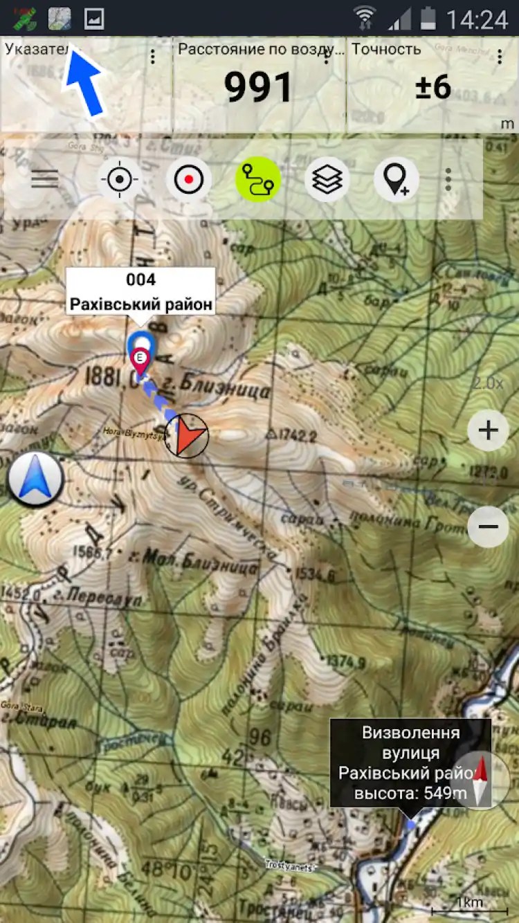
A program that includes a set of high-quality topographic cards, some of which was created by the Russian General Staff.
application Soviet military maps Includes topographic maps of the world, providing continuous coating worldwide on a scale of 100K-500K, roads, terrain and images from a satellite from Google cards, as well as a number of open street cards.
A pleasant feature of the application Soviet military cards for Android It is the presence of a large number of roads not applied to other cards. It is also worth noting that Soviet maps have lost their relevance for developed countries, since they were created in the 80s and use them just for African and Asia countries. In other cases, it is recommended to use Google maps and OSM layers.
Download the app Soviet military maps: one of the best off-road navigation applications on your Android.
Security Guarantee
On the Freesoft website you can download the official version of the Soviet Military Cards Free without torrents for a direct link from your own server.
- All files pass the daily rechecking antivirus with new signatures!
- Freesoft Member of the Kaspersky White List program.
Applications marked by the Kaspersky Trusted logo were added to the "White List" base, as not containing viruses and malicious codes. We guarantee that you download unchanged copies of the original files transferred to Kaspersky Labs for testing. You can be sure - on your device there will be an actual version of the Soviet Military Cards Free without viruses. - Check the links to the authors' sites, however, before downloading, we strongly recommend reading the reviews about the application of the Soviet Military Cards Free on our website.
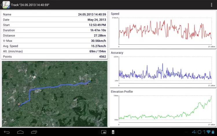
Screenshots


SD SDHC MS MS MMC Memory Cards
Sickle and hammer passage 4 endings
Passage of Xenus 2 White Gold Full Passage
Guide and Passage by "Disciples II: Dark Prophecy"
Passage Full Passage of Silent Hill 2