In the era of the great geographical discoveries, travelers and discoverers were faced with two most important tasks: measuring distances and determining their location on the earth's surface. The Greeks had a theoretical basis for solving these problems, but they did not have sufficiently accurate instruments and maps.
Interesting fact. When Spain and Portugal decided to agree on the division of the New World into spheres of influence, they could not draw the dividing line on the map accurately enough, since at that time they did not know how to determine the longitude of a place and distance on the map. In this regard, constant disputes and conflicts arose between states.
Measuring distances using a degree network. To calculate distances on a map or globe, you can use the following values: the length of an arc of 1 ° meridian and 1 ° of the equator is approximately 111 km. For meridians, this is always true, and the length of an arc of 1 ° along the parallels decreases towards the poles (the magnitude of the arc at 1 ° parallel at the equator is 111 km, at 20 ° north or south latitude - 105 km, etc.). At the poles, it is 0 (since the pole is a point). Therefore, it is necessary to know the number of kilometers corresponding to the length of 1 ° of the arc of each particular parallel. This number is written on each parallel on the hemisphere map. To determine the distance in kilometers between two points lying on the same meridian, the distance between them in degrees is calculated, and then the number of degrees is multiplied by 111 km. To determine the distance between two points on the equator, you also need to determine the distance between them in degrees, and then multiply by 111 km.
Measuring distances using a scale. The extent of a geographic feature can also be determined using a scale. The scale of the map shows how many times the distance on the map is reduced relative to the real distance on the ground. Therefore, having drawn a straight line (if you need to know the distance in a straight line) between two points and using a ruler to measure this distance in centimeters, you should multiply the resulting number by the magnitude of the scale. For example, on a map with a scale of 1: 100,000 (in 1 cm to 1 km), the distance is 5 cm, that is, on the ground this distance is 1 × 5 \u003d 5 (km). You can also measure the distance on the map using a compass-measuring device. In this case, it is convenient to use a linear scale.
Measuring the length of a curved line (for example, the length of a river) from a map. For measurement you can use caliper, curvimeteror thin damp thread.Suppose the measurement is carried out on a map with a scale of 1: 5,000,000 (1 cm 50 km). A small solution (2–3 mm) is attached to the measuring compass in order to be able to measure the small bends of the river, and they walk along the river, counting the steps. Then, multiplying the size of the compass opening (for example, 3 mm) by the number of steps (suppose 49), find the total length of the river on the map:
3 mm × 49 \u003d 147 mm \u003d 14.7 cm.
Thus, the length of the river will be 50 km × 14, 7 \u003d 735 km.
Can measure the length of a river curvimeter – a special device for measuring the lengths of curved lines on maps and plans. The curvimeter wheel is rolled along a curved line (rivers, roads, etc.), and the curvimeter counter counts the revolutions, indicating the desired line length.
You can measure the length of the curve with a damp, thin thread. It is laid out along all the meanders of the river. Then, straightening the thread without strong tension, measure its length in centimeters, and the scale determines the length of the river in reality.
If the length of a river is measured using a small-scale map, the result is less than the actual length of this river. This is due to the fact that it is impossible to show all the small bends of its channel on small-scale maps. Topographic maps give more opportunity to reflect all the bends of the channel, moreover, the distortions on them are very small. Therefore, the most accurate measurement results can be obtained from topographic maps.
Odometer
When developing a route for a hike, an important criterion is its length. Depending on this, the complexity and duration of the upcoming route are calculated, the time required to complete it, the required average speed of movement, the supply of water and food is determined, the minimum permissible degree of preparedness of future participants is determined. The methods and methods of developing the route itself may be different, but everything depends on the distance that you are ready to cover in the time allotted for its passage. A lot will depend on the accuracy of your measurements and calculations, in particular, whether you will be in time for the planned return train, or you will have to look for a place in the hotel or sit on the platform while waiting for the morning train.
There are many tools and methods for measuring distances on a map, but not all of them are equally applicable and convenient for accurately measuring the length of future routes along winding roads.
As a means of measuring segments on the map, you can use the usual ruler or compasses. But as you might guess, all these devices are designed to measure straight segments, and a bicycle route is rarely a set of straight lines, unless you are riding along the streets of the city. When measuring a route passing along winding roads and paths using linear tools, you will certainly face the need for additional calculations, including determining the magnitude of the error of your measurements, since a normal smooth road bend when measured with a ruler will look like a polyline consisting of many short straight lines segments. At the same time, the longer and more winding the route, the greater the error will be allowed in your measurements and the more approximately the total length of the route will be determined, especially if you use a small-scale map to plot the route.
More accurate results can be obtained when using a thread with transverse dots-divisions pre-applied to it using the same ruler, corresponding to the centimeter scale. However, in this case, the measurement accuracy will directly depend on your accuracy and patience when laying the thread on the surface of the card.
Fortunately, for a long time there has been a special uncomplicated device designed just for taking measurements on a map of both straight and winding segments called a curvimeter. Curvimeter (from Latin curvus - curve and ... meter), a device for measuring the lengths of segments of curves and winding lines on topographic plans, maps and graphic documents.
The curvimeter is manufactured with circular and rectilinear scales. Each type of curvimeter is produced in two versions: with a fixed dial and a movable hand or index; with movable dial and fixed index. To measure the length of the line, the Curvimeter wheel is rolled along this line. The distance measured by the Curvimeter in one revolution corresponds to the length of the scale of 100 cm.The measurement error of a straight line segment with a length of at least 50 cm is no more than 0.25 cm.
The mechanical curvimeter (shown in the figure) has a metric and inch scale. The metric divisions correspond to 1 cm, 0.05 inches in inches. The error in measuring a segment with a length of 50 cm does not exceed 0.5%.
Thus, when using a curvimeter, you will be able to measure the winding section of the route you need with the least cost and with the greatest accuracy. However, here you should remember a few simple rules for measuring a route using this device.
First, when measuring the total length of a route, do not try to measure all of its length from start to finish at once. It is better to measure in segments - from one important landmark to another. And the point is not at all that the length of the scale may not be enough for you. Simply, with an increase in the length of the measured segment, the degree of measurement error increases, an uncomfortable position, fatigue or trembling of the hand can also affect the measurement accuracy in a bad way.
Second, use a larger map whenever possible. In practice, a map with a scale of 1: 50,000 (five hundred meters) or 1: 100,000 (kilometer) will do just fine. Just do not be lazy to carefully trace all the bends of the road with a curvimeter.
Thirdly, do not be too lazy to measure each segment several times. This will prevent accidental errors. If you use a conventional mechanical curvimeter, and not an electronic analogue that allows you to measure with tenths or even thousandths, determining by eye the remaining "tail" by eye, which is very important on maps with a scale of less than 1: 100,000, do not always try to round in one direction ( more or less) use at least approximate tenths.
Fourthly, in the intervals between the main landmarks, do not be too lazy to separately measure the distances to minor landmarks along the route, for example, a bridge over a channel, a crossroads, a deep ravine, etc. Thus, as mentioned above, you will be able to constantly monitor your location on the route and have an accurate idea of \u200b\u200bthe remaining distance to the finish line even without a GPS receiver, but only with the help of a map with marked distances to landmarks.
When plotting the measurement results on the map, it seems convenient to use a fractional record A / B., Where A is the distance from the previous landmark, and B is the distance from the starting point of the route. This method makes it easy to navigate in space without unnecessary mathematical calculations. This is relevant, for example, when you need to inform your fellow travelers, especially those who like to get ahead from the main group, the exact distance to the landmark near which you need to turn off, wait for the group, etc. In addition, if you made radial sorties on any part of the route or accidentally made an unplanned detour, for example, bypassing a blurred section of the road, you do not have to make adjustments to the pre-marked marks on the map, rewrite them or constantly keep in mind the number of "extra" kilometers, for which you will have to constantly make an amendment.
An example of measuring and plotting its results on the map:
Start (0/0) - turn right, exit from the asphalt highway onto a dirt road (3/3) - bridge over the river (2/5) - Dubki village (7/13) - Lesnoy village (14/27) - bridge over brook (5/32) - intersection with an asphalt highway (8/40) - Konechnaya railway station (10/50).
And a few words about the variety of shapes and varieties of curvimeters that are presented on the Russian market today.
As mentioned above, there are two main types of curvimeters: mechanical and electronic.
In the device of mechanical curvimeters, regardless of the specific model, there are no special fundamental differences, with the exception of the type of scale (rectilinear and circular) and the principle of displaying the measurement results (with a fixed dial and a movable hand or index; with a movable dial and a fixed index). As a rule, this is a plastic device weighing about 50 grams of rather modest size. For example, the Russian-made KU-A curvimeter shown in the figure has dimensions of 50x20x100 (in a case).
This curvimeter has been produced in our country for more than a decade unchanged, except now without the USSR quality mark, and was included in the mandatory list of items as part of the officer's tablet. It was standardized back in Soviet times and complies with TU 25-07-1039-74. The cost of this copy is about 500 rubles.
The curvimeter of the Swedish company is arranged in about the same way. Silva... However, the fixed dial has more complex markings for measurements on eight scales.
The cost of such a curvimeter is about 1000 rubles.
Another example of a Russian-made mechanical curvimeter, made in the form of a key fob and additionally equipped with a compass.
The dial of the curvimeter has scales for maps of 1: 5000, 1: 20,000 and 1: 50,000. as well as a metric scale, the division of which corresponds to 1 centimeter.
Its cost is 120 rubles.
another sample with survive.som
Distance measurement in mm., Cm., M. Miles and km.
- Measuring range: 10 m. (Actual size)
- Features: setting the scale
- Metallic wheel for measurements
Diameter 4.5cm
Length 9.7cm
Materials: plastic, steel, plastic glass.
price RUB 215.00
In general, mechanical curvimeters have several main advantages:
- simplicity of design and use;
- the absence of electronic circuits and other complex elements, suggests the possibility of its use in any climatic, weather and temperature conditions;
- complete non-volatility due to the lack of batteries as such;
- good impact resistance and the impossibility of disabling it as a result of water procedures.
All of the above makes a mechanical curvimeter most suitable for use in the field. The main and probably the only drawback of such a curvimeter is the need to determine tenths of the division price "by eye".
Now let's turn to the variety of electronic curvimeters. Here, the cost of one copy ranges from three hundred to five thousand rubles, depending on the complexity of the device and the number of basic and additional functions in it. As in the production of many other electronic devices, manufacturers of electronic curvimeters rarely avoid the temptation to endow it with a host of additional functions, both useful and not so much.
For example, one of the simplest electronic curvimeters of the same Swedish company Silva, entitled Silva Digital Map Measurer made in the form of a key fob, and in addition to performing the main function - measuring the distance on the map, it is additionally equipped with:
Calculator;
- mini flashlight;
- a compass.
Its cost is about\u003e 2000 rubles.
A much more sophisticated high-precision curvimeter made in the USA called "Scal Master II", is designed to perform complex graphical measurements and calculations, has its own software, connectivity to a personal computer and has 91 architectural and engineering functions.
This device processes 50 Anglo-American values \u200b\u200b(feet, inches, etc.) and 41 metric values, which allows you to work with any maps and drawings. The most commonly used type of measurement can be entered and the instrument will automatically translate scale measurements. Has the ability to save data. Has the ability to connect to a computer using the PC-Interface Kit. Compatible with Windows. Works with Excel, Lotus.
Curvimeter Specifications Scale Master II:
Size: 182 x 41 x 15mm
Weight: 54g
Wheel material: one-piece polymer
Email power supply: 2 X 3 Volt - lithium
Useful life: up to 400 hours
Automatic shutdown: 5 min.
Number of buttons: 12
Working temperatures: 0 - 55 ° С
Display size: 19 x 64 mm.
The cost of such a device + PC connection kit -\u003e 11,000 rubles
Summarizing the information about electronic curvimeters, we can conclude that their use in the field, especially more complex analogs, is associated with some difficulties. Exposure to external influences such as cold and moisture, dependence on the presence of batteries and significantly lower shock resistance suggest the use of such a device primarily in the greenhouse conditions of urban premises for preliminary development of routes. At the same time, the indisputable advantage of the electronic curvimeter will be the maximum accuracy of measurements, and the possibility of their immediate processing, for example, converting them into kilometers, depending on the previously set scale.
Measuring distances on the map. Study of the site. Reading the map along the route
Study of a site
By the relief and local objects depicted on the map, one can judge the suitability of a given area for organizing and conducting a battle, for the use of military equipment in battle, for observation conditions, firing, orientation, camouflage, and also for maneuverability.
The presence on the map of a large number of settlements and individual forest tracts, cliffs and gullies, lakes, rivers and streams indicates the roughness of the terrain and a limited view, which will impede the movement of military and transport equipment off the roads, create difficulties in organizing observation. At the same time, the rugged nature of the relief creates good conditions for sheltering and protecting subunits from the effects of weapons of mass destruction of the enemy, and forest tracts can be used to camouflage subunit personnel, military equipment, etc.
By the nature of the layout, size and font of the signature of settlements, it can be said that some settlements belong to cities, others - to urban-type settlements, and still others - to rural-type settlements. The orange color of the neighborhoods indicates the predominance of fire-resistant buildings. Black rectangles located close to each other within the quarters indicate the dense nature of the building, and the yellow fill - the non-fire resistance of buildings.
In a settlement, there may be a weather station, a power station, a radio mast, a fuel warehouse, a plant with a pipe, a railway station, a flour mill and other facilities. Some of these local items can serve as good landmarks.
The map can show a relatively developed network of roads of various classes. If there is a signature on the conventional road sign, for example, 10 (14) B. This means that the covered part of the road has a width of 10 m, and from ditch to ditch - 14 m, the covering is cobblestone. A single-track (double-track) railway can pass through the area. Studying the route of movement along the railway, you can find on the map individual sections of roads that pass along an embankment or in a cut with a specified depth.
A more detailed study of roads can establish: the presence and characteristics of bridges, embankments, excavations and other structures; the presence of difficult sections, steep descents and ascents; the possibility of leaving the roads and driving next to them.
Water surfaces are depicted on maps in blue or light blue, so they stand out clearly from the conventional symbols of other local objects.
By the nature of the font of the signature of the river, one can judge its navigability. An arrow and a number on the river indicate in which direction it flows and at what speed. The signature, for example: means that the width of the river in this place is 250 m, the depth is 4.8 m, and the bottom is sandy. If there is a bridge across the river, its characteristics are given next to the image of the bridge.
If the river on the map is depicted as a single line, then this indicates that the width of the river does not exceed 10 m, if the river is depicted in two lines, and its width is not indicated on the map, its width can be determined by the indicated characteristics of the bridges.
If the river is passable ford, then the conventional ford sign indicates the depth of the ford and the bottom soil.
When studying the soil and vegetation cover, you can find on the map forest areas of various sizes. Explanatory symbols on the green shading of the forest area can indicate a mixed composition of tree species, deciduous or coniferous forest. The signature, for example:, says that the average height of trees is 25 m, their thickness is 30 cm, the average distance between them is 5 m, which allows us to conclude that it is impossible for cars and tanks to move through the forest off roads.
The study of the relief on the map begins with determining the general nature of the irregularities of that part of the terrain on which the combat mission is to be performed. For example, if the map shows a hilly relief with relative heights of 100-120 m, and the distance between the contours (inception) is from 10 to 1 mm, this indicates a relatively small steepness of the slopes (from 1 to 10 °).
A detailed study of the terrain on the map is associated with solving problems of determining the heights and mutual excess of points, the type, direction of the steepness of the slopes, characteristics (depth, width and length) of hollows, ravines, gullies and other relief details.
Measuring distances on the map
Measurement from a map of straight and winding lines
To determine the distance between points of the terrain (objects, objects) on the map, using a numerical scale, you need to measure the distance between these points on the map in centimeters and multiply the resulting number by the magnitude of the scale.
For example, on a map of scale 1: 25000, measure the distance between the bridge and the windmill with a ruler; it is equal to 7.3 cm, multiply 250 m by 7.3 and get the desired distance; it is equal to 1825 meters (250x7.3 \u003d 1825).
Determine the distance between points on the map using a ruler
The small distance between two points in a straight line is easier to determine using a linear scale. To do this, it is enough to use a compass-measuring device, the solution of which is equal to the distance between the given points on the map, to apply to a linear scale and take a reading in meters or kilometers. In the figure, the measured distance is 1070 m.
![]()
Large distances between points along straight lines are usually measured using a long ruler or a caliper.
In the first case, a numerical scale is used to determine the distance along the map using a ruler.
In the second case, the solution "step" of the measuring compass is set so that it corresponds to an integer number of kilometers, and an integer number of "steps" is laid on the segment measured on the map. A distance that does not fit into an integer number of "steps" of the measuring compass is determined using a linear scale and added to the resulting number of kilometers.
In the same way, distances are measured along winding lines. In this case, the "step" of the measuring compass should be taken 0.5 or 1 cm, depending on the length and degree of tortuosity of the measured line.
To determine the length of the route on the map, a special device called a curvimeter is used, which is especially convenient for measuring winding and long lines.
The device has a wheel, which is connected by a gear system with an arrow.
When measuring the distance with the curvimeter, set its arrow to division 99. Holding the curvimeter in a vertical position, guide it along the measured line, without lifting it from the map along the route so that the scale readings increase. Having reached the end point, count the measured distance and multiply it by the denominator of the numerical scale. (In this example 34x25000 \u003d 850,000, or 8500 m)
Accuracy of measuring distances on the map. Distance Corrections for Slope and Wink of Lines
The accuracy of determining the distances on the map depends on the scale of the map, the nature of the measured lines (straight, winding), the chosen method of measurement, the terrain and other factors.
You can most accurately determine the distance on the map in a straight line.
When measuring distances using a compass-gauge or a ruler with millimeter divisions, the average value of the measurement error on flat terrain usually does not exceed 0.7-1 mm on a map scale, which is 17.5-25 m for a 1: 25000 scale map, scale 1: 50,000 - 35-50 m, scale 1: 100,000 - 70-100 m.
In mountainous areas, with a large steepness of the slopes, errors will be greater. This is due to the fact that when surveying the terrain, not the length of the lines on the surface of the Earth is plotted on the map, but the length of the projections of these lines onto the plane.
For example, with a slope steepness of 20 ° and a distance of 2120 m on the ground, its projection onto the plane (distance on the map) is 2000 m, that is, 120 m less.
It is calculated that at an angle of inclination (steepness of the slope) of 20 °, the obtained result of measuring the distance on the map should be increased by 6% (add 6 m by 100 m), at an angle of inclination of 30 ° - by 15%, and at an angle of 40 ° - by 23 %.
When determining the length of the route on the map, it should be borne in mind that the distances along the roads measured on the map using a compass or curvimeter are in most cases shorter than the actual distances.
This is explained not only by the presence of descents and ascents on the roads, but also by some generalization of the meanders of the roads on the maps.
Therefore, the result of measuring the route length obtained from the map should be multiplied by the coefficient indicated in the table, taking into account the nature of the terrain and the scale of the map.
The simplest ways to measure areas on a map
An approximate estimate of the size of the areas is made by eye using the squares of the kilometer grid available on the map. Each square of a grid of maps of scales 1: 10000 - 1: 50,000 on the ground corresponds to 1 km2, a square of a grid of maps of a scale of 1: 100000 - 4 km2, a square of a grid of maps of a scale of 1: 200000 - 16 km2.
More precisely, the areas are measured with a palette, which is a sheet of transparent plastic coated with a grid of squares with a side of 10 mm (depending on the scale of the map and the required measurement accuracy).
By placing such a palette on the measured object on the map, one counts on it first the number of squares that completely fit inside the object's contour, and then the number of squares intersected by the object's contour. Each of the incomplete squares is taken as half a square. As a result of multiplying the area of \u200b\u200bone square by the sum of the squares, the area of \u200b\u200bthe object is obtained.
On squares of scales 1: 25000 and 1: 50,000, it is convenient to measure the area of \u200b\u200bsmall areas with an officer's ruler, which has special rectangular cutouts. The areas of these rectangles (in hectares) are indicated on the ruler for each scale of the garta.
Reading the map along the route
Reading a map means correctly and fully perceiving the symbolism of its conventional signs, quickly and accurately recognizing from them not only the type and varieties of objects depicted, but also their characteristic properties.
Studying the terrain on a map (reading a map) includes determining its general nature, quantitative and qualitative characteristics of individual elements (local objects and landforms), as well as determining the degree of influence of a given terrain on the organization and conduct of a battle.
Studying the terrain on the map, it should be remembered that since its creation, changes in the terrain could have occurred that are not reflected on the map, that is, the content of the map will in some way not correspond to the actual state of the terrain at the moment. Therefore, the study of the area on the map is recommended to start with familiarization with the map itself.
Familiarization with the map. When familiarizing with the map, according to the information placed in the out-of-frame design, the scale, the height of the relief section and the time of creating the map are determined. Data on the scale and height of the relief section will allow you to establish the degree of detail of the image on this map of local objects, forms and relief details. Knowing the magnitude of the scale, you can quickly determine the size of local objects or their distance from each other.
Information about the time of creation of the map will make it possible to preliminary determine the correspondence of the content of the map to the actual state of the area.
Then read and, if possible, memorize the values \u200b\u200bof the declination of the magnetic needle, direction corrections. Knowing the direction correction from memory, you can quickly translate directional angles into magnetic azimuths or orient the map on the ground along the line of the kilometer grid.
General rules and sequence for studying the area on the map. The sequence and degree of detail in the study of the terrain is determined by the specific conditions of the combat situation, the nature of the combat mission of the subunit, as well as the seasonal conditions and tactical and technical data of the combat equipment used in the performance of the assigned combat mission. When organizing defense in a city, it is important to determine the nature of its planning and development, to identify durable buildings with basements and underground structures. In the event that the route of the movement of the unit passes through the city, there is no need to study the features of the city in such detail. When organizing an offensive in the mountains, the main objects of study are passes, mountain passes, gorges and gorges with adjacent heights, the shape of slopes and their influence on the organization of the fire system.
The study of the terrain, as a rule, begins with a determination of its general nature, and then a detailed study of individual local objects, forms and details of the relief, their influence on the conditions of observation, camouflage, passability, protective properties, conditions of fire and orientation.
Determination of the general nature of the terrain is aimed at identifying the most important features of the relief and local objects that have a significant impact on the implementation of the task. When determining the general nature of the terrain on the basis of familiarization with the relief, settlements, roads, hydrographic network and vegetation cover, the variety of this area, the degree of its ruggedness and closure, is identified, which makes it possible to preliminarily determine its tactical and protective properties.
The general nature of the terrain is determined by a quick overview of the map of the entire study area.
At first glance at the map, one can say about the presence of settlements and individual tracts of forest, cliffs and gullies, lakes, rivers and streams indicating the roughness of the terrain and a limited view, which inevitably complicates the movement of military and transport equipment off the roads, creates difficulties in organizing observation ... At the same time, the rugged nature of the relief creates good conditions for sheltering and protecting subunits from the effects of weapons of mass destruction of the enemy, and forest tracts can be used to camouflage subunit personnel, military equipment, etc.
So, as a result of determining the general nature of the terrain, a conclusion is made about the availability of the area and its individual directions for the actions of subunits in vehicles, and also outline the lines and objects that should be studied in more detail, taking into account the nature of the combat mission to be performed in this area of \u200b\u200bthe terrain.
A detailed study of the terrain is aimed at determining the qualitative characteristics of local objects, forms and details of the relief within the boundaries of the unit's actions or along the upcoming route of movement. On the basis of obtaining such data from the map and taking into account the interconnection of topographic elements of the terrain (local objects and relief), an assessment of the conditions of passability, camouflage and observation, orientation, firing is made, and the protective properties of the terrain are determined.
Determination of the qualitative and quantitative characteristics of local objects is made on the map with relatively high accuracy and great detail.
When studying on a map of settlements, the number of settlements, their type and dispersion is determined, the degree of habitation of a particular site (district) of the area is determined. The main indicators of the tactical and protective properties of settlements are their area and configuration, the nature of planning and development, the presence of underground structures, the nature of the terrain on the outskirts of the settlement.
Reading the map, using the conventional signs of settlements, they establish the presence, type and location of them in a given area of \u200b\u200bthe terrain, determine the nature of the outskirts and layout, building density and fire resistance of buildings, the location of streets, main thoroughfares, the presence of industrial facilities, outstanding buildings and landmarks.
When studying the road network map, the degree of development of the road network and the quality of roads are specified, the conditions for the passability of a given area and the possibility of effective use of vehicles are determined.
A more detailed study of the roads establishes: the presence and characteristics of bridges, embankments, excavations and other structures; the presence of difficult sections, steep descents and ascents; the possibility of leaving the roads and driving next to them.
When studying dirt roads, special attention is paid to identifying the carrying capacity of bridges and ferry crossings, since on such roads they are often not designed for the passage of heavy wheeled and tracked vehicles.
Studying hydrography, the presence of water bodies is determined on the map, the degree of indentedness of the terrain is specified. The presence of water bodies creates good conditions for water supply and transportation by waterways.
Water surfaces are depicted on maps in blue or light blue, so they stand out clearly from the conventional symbols of other local objects. When studying rivers, canals, streams, lakes and other water barriers on a map, the width, depth, current speed, the nature of the bottom, banks and adjacent terrain are determined; the presence and characteristics of bridges, dams, locks, ferry crossings, fords and sections convenient for crossing are established.
When studying the soil and vegetation cover, the presence and characteristics of forest and shrub areas, swamps, salt marshes, sands, stony placers and those elements of soil and vegetation cover that can have a significant impact on the conditions of passability, camouflage, observation and the possibility of shelter are established on the map.
The characteristics of the forest area studied on the map allow us to conclude that it can be used for a secret and dispersed location of units, as well as the passability of the forest along roads and clearings. Good landmarks in the forest for determining your location and orientation in motion are the forester's house and clearings.
The characteristics of the swamps are determined by the outlines of conventional symbols. However, when determining the passability of swamps on the map, one should take into account the season and weather conditions. During the period of rains and mudslides, swamps, shown on the map with a conventional sign as passable, in reality may turn out to be difficult to pass. In winter, during severe frosts, rugged swamps can become easily passable.
The study of the relief on the map begins with determining the general nature of the irregularities of that section of the terrain on which the combat mission is to be performed. At the same time, the presence, location and interconnection of the most typical typical forms and relief details for a given site are established, their influence on the conditions of passability, observation, firing, camouflage, orientation and organization of protection against weapons of mass destruction is determined in general terms. The general nature of the relief can be quickly determined by the density and outline of contour lines, elevation marks and conventional signs of relief details.
A detailed study of the terrain on the map is associated with solving problems of determining the heights and mutual excess of points, the type and direction of the steepness of the slopes, characteristics (depth, width and length) of ravines, ravines, gullies and other relief details.
Naturally, the need for solving specific tasks will depend on the nature of the assigned combat mission. For example, the definition of invisibility fields will be required when organizing and conducting reconnaissance by observation; determination of the steepness, height and length of the slopes will be required when determining the terrain passability conditions and choosing a route of movement, etc.
1.1 Map scales
Map scale shows how many times the length of the line on the map is less than its corresponding length on the ground. It is expressed as the ratio of two numbers. For example, a scale of 1: 50,000 means that all terrain lines are depicted on the map with a reduction of 50,000 times, that is, 1 cm on the map corresponds to 50,000 cm (or 500 m) on the terrain.
Fig. 1. Registration of numerical and linear scales on topographic maps and city plans
The scale is indicated under the lower side of the map frame in digital terms (numerical scale) and in the form of a straight line (linear scale), on the segments of which the corresponding distances on the terrain are signed (Fig. 1). The scale value is also indicated here - the distance in meters (or kilometers) on the terrain, corresponding to one centimeter on the map.
It is useful to remember the rule: if you cross out the last two zeros on the right side of the relationship, then the remaining number will show how many meters on the ground correspond to 1 cm on the map, that is, the magnitude of the scale.
When comparing several scales, the larger one will be the one with the lower number on the right side of the ratio. Let us assume that there are maps of scales 1: 25000, 1: 50000 and 1: 100000 for the same area of \u200b\u200bthe terrain. Of these, a scale of 1: 25,000 will be the largest, and a scale of 1: 100,000 is the smallest.
The larger the scale of the map, the more detailed the terrain is depicted on it. With a decrease in the scale of the map, the number of terrain details applied to it decreases.
The detail of the image of the terrain on topographic maps depends on its nature: the less details the terrain contains, the more fully they are displayed on maps of smaller scales.
In our country and many other countries, the following are accepted as the main scales of topographic maps: 1: 10000, 1: 25000, 1: 50,000, 1: 100000, 1: 200000, 1: 500000 and 1: 1,000,000.
Cards used in troops are subdivided into large-scale, medium-scale and small-scale.
| Map scale | Card name | Card classification | |
| in scale | for the main purpose | ||
| 1:10 000 (in 1 cm 100 m) | ten thousandth | large-scale | tactical |
| 1:25 000 (in 1 cm 250 m) | twenty-five thousandth | ||
| 1:50 000 (in 1 cm 500 m) | five thousandth | ||
| 1: 100,000 (in 1 cm 1 km) | hundred thousandth | medium-scale | |
| 1: 200,000 (in 1 cm 2 km) | two hundred thousandth | operational | |
| 1: 500,000 (in 1 cm 5 km) | five hundred thousandth | small-scale | |
| 1: 1,000,000 (in 1 cm 10 km) | millionth | ||
1.2. Measurement from a map of straight and winding lines
To determine the distance between points of the terrain (objects, objects) on the map, using a numerical scale, you need to measure the distance between these points on the map in centimeters and multiply the resulting number by the magnitude of the scale.
For example, on a map of scale 1: 25000 we measure the distance between the bridge and the windmill with a ruler (Fig. 2); it is equal to 7.3 cm, multiply 250 m by 7.3 and get the desired distance; it is equal to 1825 meters (250x7.3 \u003d 1825).
 Fig. 2. Determine the distance between points on the map using a ruler.
The small distance between two points in a straight line is easier to determine using a linear scale (Fig. 3). To do this, it is enough to use a pair of compasses, the solution of which is equal to the distance between the given points on the map, to apply to a linear scale and take a reading in meters or kilometers. In fig. 3 the measured distance is 1070 m.
 Fig. 3. Measurement of distances on the map with a compass-meter on a linear scale
 Fig. 4. Measurement of distances on the map with a compass-meter along winding lines
Large distances between points along straight lines are usually measured using a long ruler or a caliper.
In the first case, a numerical scale is used to determine the distance on the map using a ruler (see Fig. 2).
In the second case, the solution "step" of the measuring compass is set so that it corresponds to an integer number of kilometers, and an integer number of "steps" is laid on the segment measured on the map. A distance that does not fit into an integer number of "steps" of the measuring compass is determined using a linear scale and added to the resulting number of kilometers.
In the same way, measure the distance along the winding lines (Fig. 4). In this case, the "step" of the measuring compass should be taken 0.5 or 1 cm, depending on the length and degree of tortuosity of the measured line.
 Fig. 5. Distance measurements with a curvimeter
To determine the length of the route on the map, a special device is used, called a curvimeter (Fig. 5), which is especially convenient for measuring winding and long lines.
The device has a wheel, which is connected by a gear system with an arrow.
When measuring the distance with the curvimeter, set its arrow to division 99. Holding the curvimeter in a vertical position, guide it along the measured line, without lifting it from the map along the route so that the scale readings increase. Having reached the end point, count the measured distance and multiply it by the denominator of the numerical scale. (In this example 34x25000 \u003d 850,000, or 8500 m)
1.3. Accuracy of measuring distances on the map. Distance Corrections for Slope and Wink of Lines
Accuracy of determining distances on the map depends on the scale of the map, the nature of the measured lines (straight, winding), the chosen method of measurement, terrain and other factors.
You can most accurately determine the distance on the map in a straight line.
When measuring distances using a compass-gauge or a ruler with millimeter divisions, the average value of the measurement error on flat terrain usually does not exceed 0.7-1 mm on a map scale, which is 17.5-25 m for a 1: 25000 scale map, scale 1: 50,000 - 35-50 m, scale 1: 100,000 - 70-100 m.
In mountainous areas, with a large steepness of the slopes, errors will be greater. This is due to the fact that when surveying the terrain, not the length of the lines on the surface of the Earth is plotted on the map, but the length of the projections of these lines onto the plane.
For example, with a slope steepness of 20 ° (Fig. 6) and a distance on the terrain of 2120 m, its projection onto the plane (distance on the map) is 2000 m, that is, 120 m less.
It is calculated that at an angle of inclination (steepness of the slope) of 20 °, the obtained result of measuring the distance on the map should be increased by 6% (add 6 m by 100 m), at an angle of inclination of 30 ° - by 15%, and at an angle of 40 ° - by 23 %.
 Fig. 6. Projection of the length of the slope on the plane (map)
When determining the length of the route on the map, it should be borne in mind that the distances along the roads measured on the map using a compass or curvimeter are in most cases shorter than the actual distances.
This is explained not only by the presence of descents and ascents on the roads, but also by some generalization of the meanders of the roads on the maps.
Therefore, the result of measuring the route length obtained from the map should be multiplied by the coefficient indicated in the table, taking into account the nature of the terrain and the scale of the map.
1.4. The simplest ways to measure areas on a map
An approximate estimate of the size of the areas is made by eye using the squares of the kilometer grid available on the map. Each square of the grid of maps of scales 1: 10000 - 1: 50,000 on the ground corresponds to 1 km2, a square of the grid of maps of scale 1 : 100000 - 4 km2, to the square of the grid of maps of scale 1: 200000 - 16 km2.
More precisely, areas are measured palette, which is a sheet of transparent plastic coated with a grid of squares with a side of 10 mm (depending on the scale of the map and the required measurement accuracy).
By placing such a palette on the measured object on the map, one counts on it first the number of squares that completely fit inside the object's contour, and then the number of squares intersected by the object's contour. Each of the incomplete squares is taken as half a square. As a result of multiplying the area of \u200b\u200bone square by the sum of the squares, the area of \u200b\u200bthe object is obtained.
On squares of scales 1: 25000 and 1: 50,000, it is convenient to measure the area of \u200b\u200bsmall areas with an officer's ruler, which has special rectangular cutouts. The areas of these rectangles (in hectares) are indicated on the ruler for each scale of the garta.
2. Azimuths and directional angle. Magnetic declination, meridian convergence and heading correction
True azimuth (Ai) - horizontal angle, measured clockwise from 0 ° to 360 ° between the north direction of the true meridian of a given point and the direction to the object (see Fig. 7).
Magnetic azimuth (Am) - horizontal angle, measured clockwise from 0e to 360 ° between the north direction of the magnetic meridian of a given point and the direction to the object.
Directional angle (α; ДУ) - horizontal angle measured clockwise from 0 ° to 360 ° between the north direction of the vertical grid line of the given point and the direction to the object.
Magnetic declination (δ; CK) - the angle between the north direction of the true and magnetic meridians at a given point.
If the magnetic needle deviates from the true meridian to the east, then the declination is east (taken into account with the + sign), when the magnetic needle deviates to the west, it is west (taken into account with the - sign).
 Fig. 7. Angles, directions and their relationship on the map
Convergence of meridians (γ; Sat) - the angle between the north direction of the true meridian and the vertical line of the coordinate grid at this point. When the grid line deviates to the east, the meridian approaches the east (taken into account with the + sign), when the grid line deviates to the west - the west (taken into account with the - sign).
Direction correction (PN) - the angle between the north direction of the vertical grid line and the direction of the magnetic meridian. It is equal to the algebraic difference between the magnetic declination and the convergence of the meridians:
![]()
3. Measurement and construction of directional angles on the map. Transition from directional angle to magnetic azimuth and back
On the ground using a compass (compass) measure magnetic azimuths directions, from which they then move to directional angles.
On the map on the contrary, measure directional angles and from them they pass to the magnetic azimuths of directions on the ground.
 Fig. 8. Changing directional angles on the map with a protractor
Directional angles on the map are measured with a protractor or chordouglometer.
Measurement of directional angles with a protractor is carried out in the following sequence:
- the reference point to which the directional angle is measured is connected by a straight line with a standing point so that this straight line is greater than the radius of the protractor and intersects at least one vertical line of the coordinate grid;
- align the center of the protractor with the intersection point, as shown in Fig. 8 and the directional angle is measured along the protractor. In our example, the directional angle from point A to point B is 274 ° (Fig. 8, a), and from point A to point C - 65 ° (Fig. 8, b).
In practice, it is often necessary to determine the magnetic AM from the known directional angle ά, or, conversely, the angle ά to the known magnetic azimuth.
Transition from directional angle to magnetic azimuth and back
The transition from the directional angle to the magnetic azimuth and vice versa is performed when on the ground it is necessary to find the direction with the help of a compass (compass), the directional angle of which is measured on the map, or vice versa, when it is necessary to plot the direction on the map, the magnetic azimuth of which is measured, on the terrain with using a compass.
To solve this problem, it is necessary to know the magnitude of the deviation of the magnetic meridian of a given point from the vertical kilometer line. This value is called directional correction (PN).

 Fig. 10. Determination of the correction for the transition from the directional angle to the magnetic azimuth and vice versa
The direction correction and its constituent angles - the convergence of the meridians and the magnetic declination are indicated on the map under the southern side of the frame in the form of a diagram having the form shown in Fig. 9.
Convergence of meridians (g) - the angle between the true meridian of a point and the vertical kilometer line depends on the distance of this point from the axial meridian of the zone and can range from 0 to ± 3 °. The diagram shows the average convergence of the meridians for a given sheet of the map.
Magnetic declination (d) - the angle between the true and magnetic meridians is indicated on the diagram for the year the map was taken (updated). The text placed next to the diagram provides information on the direction and magnitude of the annual change in magnetic declination.
To avoid errors in determining the magnitude and sign of the direction correction, the following technique is recommended.
From the top of the corners on the diagram (Fig. 10) draw an arbitrary direction OM and designate the directional angle ά and the magnetic azimuth Am of this direction with the arches. Then it will immediately be seen what the magnitude and sign of the direction correction are.
If, for example, ά \u003d 97 ° 12 ", then Am \u003d 97 ° 12" - (2 ° 10 "+ 10 ° 15") \u003d 84 ° 47 " .
4. Preparation on the data card for movement in azimuths
Azimuth movement - this is the main way to navigate in areas with poor landmarks, especially at night and with limited visibility.
Its essence lies in maintaining on the ground the directions given by the magnetic azimuths and the distances determined on the map between the turning points of the planned route. Directions of movement are maintained using a compass, distances are measured in steps or using a speedometer.
The initial data for movement in azimuths (magnetic azimuths and distances) are determined from the map, and the time of movement - according to the standard and drawn up in the form of a diagram (Fig. 11) or entered into a table (Table 1). Data in this form is issued to commanders who do not have topographic maps. If the commander has his own working map, then he draws up the initial data for movement in azimuths directly on the working map.
 Fig. 11. Scheme for movement in azimuth
The route of movement in azimuths is chosen taking into account the terrain passability, its protective and camouflaging properties, so that it provides a quick and covert exit to the specified point in a combat situation.
The route usually includes roads, clearings, and other linear landmarks that make it easier to follow the direction of travel. Turning points are chosen at landmarks that are easily recognizable on the ground (for example, tower-type buildings, road intersections, bridges, overpasses, geodetic points, etc.).
It has been experimentally established that the distance between the landmarks at the turning points of the route should not exceed 1 km when driving in the daytime on foot, and when driving by car - 6-10 km.
For movement at night, landmarks are outlined along the route more often.
To provide a covert exit to the specified point, the route is planned along ravines, vegetation and other objects that provide masking of movement. It is necessary to avoid movement on the crests of hills and open areas.
The distances between the landmarks selected on the route of movement at turning points are measured along straight lines using a compass-gauge and a linear scale, or, more accurately, with a ruler with millimeter divisions. If the route is planned for hilly (mountainous) terrain, then a relief correction is introduced into the distances measured on the map.
Table 1
5. Compliance with standards
| No. of norms. | Name of the standard | Conditions (order) for the fulfillment of the standard | Trainee category | Time estimate | ||
| "Ex." | "Chorus." | "Ud." | ||||
| 1 | Determination of direction (azimuth) on the ground | The azimuth of the direction (reference point) is given. Indicate the direction corresponding to the given azimuth on the ground, or determine the azimuth to the specified landmark. The time to fulfill the standard is counted from the setting of the task to the report on the direction (azimuth value). Compliance with the standard is assessed |
Serviceman | 40 s | 45 s | 55 s |
| 5 | Preparing data for movement in azimuths | On the M 1: 50,000 map, two points are indicated at a distance of at least 4 km. Study the terrain on the map, outline the route of movement, choose at least three intermediate landmarks, determine the directional angles and distances between them. Draw up a diagram (table) of data for movement in azimuths (directional angles should be converted into magnetic azimuths, and distances - in pairs of steps). Errors that reduce the grade to "unsatisfactory":
The time to fulfill the standard is counted from the moment the card is issued to the presentation of the diagram (table). |
Officers | 8 minutes | 9 minutes | 11 minutes |
- Distance measurement
- Measuring the length of a route
- Determination of areas
When creating topographic maps, the linear dimensions of all terrain objects projected onto a level surface are reduced by a certain number of times. The amount of this reduction is called the map scale. The scale can be expressed in numerical form (numerical scale) or graphically (linear, transverse scales) - in the form of a graph. Numerical and linear scales are displayed on the bottom edge of the topographic map.
Distances on a map are measured using usually a numerical or linear scale. More accurate measurements are made using a cross-sectional scale.
Numerical scaleIs the scale of the map, expressed as a fraction, the numerator of which is one, and the denominator is a number that shows how many times the horizontal spread of the terrain lines has been reduced on the map. The smaller the denominator, the larger the map scale. For example, a scale of 1: 25,000 shows that all linear dimensions of terrain elements (their horizontal distance to a level surface) are reduced 25,000 times when displayed on a map.
Distances on the ground in meters and kilometers, corresponding to 1 cm on the map, is called the scale value. It is indicated on the map under a numerical scale.
When using a numerical scale, the distance measured on the map in centimeters is multiplied by the denominator of the numerical scale in meters. For example, on a map with a scale of 1: 50,000, the distance between two local objects is 4.7 cm; on the ground it will be 4.7 x 500 \u003d 2350 m. If the distance measured on the ground must be plotted on the map, it must be divided by the denominator of the numerical scale. For example, on the ground, the distance between two local objects is 1525 m.On a map with a scale of 1:50 000 it will be 1525: 500 \u003d 3.05 cm.
A linear scale is a graphical expression of a numerical scale. On a scale of a linear scale, the segments corresponding to the distances on the ground in meters and kilometers are digitized. This makes the process of measuring distances easier, since no calculations are required.
Simplified scale is the ratio of the line length on the map (plan) to the length of the corresponding line on the ground.
Linear measurements are made with a caliper. Long straight lines and winding lines on a map are measured piece by piece. To do this, set the solution ("step") of the measuring compass, equal to 0.5-1 cm, and with this "step" they pass along the measured line, keeping count of the permutations of the legs of the measuring compass. The remainder of the distance is measured on a linear scale. The distance is calculated by multiplying the number of permutations of the compass by the "step" in kilometers and adding the remainder to the resulting value. If there is no measuring compass, it can be replaced with a strip of paper on which the distance measured on the map or the distance plotted on it is marked with a dash.
The transverse scale is a special graph engraved on a metal plate. Its construction is based on the proportionality of the parallel line segments intersecting the sides of the corner.
The standard (normal) transverse scale has large divisions equal to 2 cm and small divisions (left) equal to 2 mm. In addition, the graph contains segments between the vertical and oblique lines, equal along the first lower horizontal line 0, "mm, 0.4 mm in the second, 0.6 mm in the third, and so on. The transverse scale can be used to measure distances on maps of any scale.
Distance measurement accuracy... The accuracy of measuring the length of straight line segments on a topographic map using a caliper and a transverse scale does not exceed 0.1 mm. This value is called the maximum graphic accuracy of measurements, and the distance on the ground, corresponding to 0.1 mm on the map, is the maximum graphic accuracy of the map scale.
The graphical error in measuring the length of the segment on the map depends on the deformation of the paper and the measurement conditions. Usually it ranges from 0.5 to 1 mm. To exclude gross errors, the measurement of the segment on the map must be performed twice. If the results obtained do not diverge by more than 1 mm, the average of the two measurements is taken as the final value of the segment length.
Errors in determining distances from topographic maps of various scales are given in the table.
Distance correction for line slope... The distance measured on the map on the ground will always be slightly less. This is because horizontal distances are measured on the map, while the corresponding lines on the ground are usually sloped.
The coefficients of conversion from the distances measured on the map to the actual ones are given in the table.
As can be seen from the table, on flat terrain, the distances measured on the map differ little from the actual ones. On maps of hilly and especially mountainous terrain, the accuracy of determining distances is significantly reduced. For example, the distance between two points, measured on a map, on terrain with an angle of inclination of 12 5о 0, is 9270 m. The actual distance between these points will be 9270 * 1.02 \u003d 9455 m.
Thus, when measuring distances on the map, it is necessary to introduce corrections for the slope of the lines (for the relief).
Determination of distances by coordinates taken from the map.
Straight-line distances of great extent in one coordinate zone can be calculated by the formula
S \u003d L- (X 42 0- X 41 0) + (Y 42 0- Y 41 0) 52 0,
where S - distance on the ground between two points, m;
X 41 0, Y 41 0 - coordinates of the first point;
X 42 0, Y 42 0 - coordinates of the second point.
This method of determining distances is used when preparing data for firing artillery and in other cases.
Measuring the length of a route
The length of the route is measured on the map, usually with a curvimeter. The standard curvimeter has two scales for measuring distances on the map: on one side metric (from 0 to 100 cm), on the other side an inch (from 0 to 39.4 inches). The curvimeter mechanism consists of a bypass wheel connected by a gear system with an arrow. To measure the length of the line on the map, first set the curvimeter arrow to the initial (zero) division of the scale by rotating the bypass wheel, and then roll the bypass wheel strictly along the measured line. The resulting reading on the curvimeter scale must be multiplied by the magnitude of the map scale.
The correct operation of the curvimeter is checked by measuring the known line length, for example the distance between the lines of the kilometer grid on the map. The error in measuring a line with a length of 50 cm with a curvimeter is no more than 0.25 cm.
The length of the route on the map can also be measured with a caliper.
The length of the route measured on the map will always be slightly shorter than the actual one, since when compiling maps, especially small-scale ones, the roads are straightened. In hilly and mountainous areas, in addition, there is a significant difference between the horizontal route and its actual length due to ups and downs. For these reasons, it is necessary to enter a correction to the route length measured on the map. Correction factors for different types of terrain and map scales are not the same, shown in the table.
The table shows that in hilly and mountainous terrain, the difference between the measured on the map and the actual length of the route is significant. For example, the length of the route measured on a 1: 100,000 scale map of the mountainous region is 150 km, and its actual length will be 150 * 1.20 \u003d 180 km.
The correction to the length of the route can be entered directly when it is measured on the map with a measuring compass, setting the "step" of the measuring compass taking into account the correction factor.
Determination of areas
The area of \u200b\u200ba plot of terrain is determined from a map, most often by counting the squares of a coordinate grid covering this plot. The size of the fractions of the squares is determined by eye or using a special palette on the officer's line (artillery circle). Each square formed by the grid lines on a map of scale 1:50 000 corresponds to 1 km 52 0 on the ground, 4 km 2 on a 1: 100 000 map, and 16 km 2 on a 1: 200 000 scale.
When measuring large areas on a map or photographic documents, a geometric method is used, which consists in measuring the linear elements of the site and then calculating its area using the geometry formulas. If the site on the map has a complex configuration, it is divided by straight lines into rectangles, triangles, trapezoids, and the areas of the resulting figures are calculated.
The area of \u200b\u200bdestruction in the area of \u200b\u200ba nuclear explosion is calculated by the formula P \u003d nR... The value of the radius R is measured on the map. For example, the radius of severe destruction at the epicenter of a nuclear explosion is 3.5 km.
P \u003d 3.14 * 12.25 \u003d 38.5 km 2.
The area of \u200b\u200bradioactive contamination of the area is calculated using the formula for determining the area of \u200b\u200bthe trapezoid. This area can be approximately calculated using the formula for determining the area of \u200b\u200ba sector of a circle

where R - circle radius, km;
and- chord, km.
Determination of azimuths and direction angles
Azimuths and directional angles. The position of an object on the ground is most often determined and indicated in polar coordinates, that is, the angle between the initial (given) direction and the direction to the object and the distance to the object. The direction of the geographic (geodetic, astronomical) meridian, magnetic meridian or vertical line of the map coordinate grid is selected as the initial one. The direction to some distant landmark can also be taken as the initial one. Depending on which direction is taken as the initial one, there are geographical (geodetic, astronomical) azimuth A, magnetic azimuth Am, directional angle a (alpha) and position angle 0.
Geographic (geodesic, astronomical) is the dihedral angle between the plane of the meridian of a given point and the vertical plane passing in a given direction, measured from the north direction clockwise (geodesic azimuth is the dihedral angle between the plane of the geodesic meridian of a given point and the plane passing through the normal to it and containing the given direction.The dihedral angle between the plane of the astronomical meridian of a given point and the vertical plane passing in this direction is called the astronomical azimuth).
Magnetic azimuth А 4m - horizontal angle measured from the north direction of the magnetic meridian clockwise.
The directional angle a is the angle between the direction passing through a given point and a line parallel to the abscissa axis, measured from the north direction of the abscissa axis clockwise.
All of the above angles can range from 0 to 360 0.
The angle of position 0 is measured in both directions from the direction taken as the initial one. Before naming the angle of the object (target) position, indicate in which direction (to the right, to the left) from the initial direction it was measured.
In nautical practice and in some other cases, directions are indicated by points. Rumbus is the angle between the north or south direction of the magnetic meridian of a given point and the direction to be determined. The value of the point does not exceed 90 0, therefore the point is accompanied by the name of the quarter of the horizon to which the direction refers: NE (northeast), NW (northwest), SE (southeast), and SW (southwest). The first letter shows the direction of the meridian from which the point is measured, and the second in which direction. For example, bearing NW 52 0 means that this direction makes an angle of 52 0 with the north direction of the magnetic meridian, which is measured from this meridian to the west.
Measurement of directional angles and geodetic azimuths on a map is performed with a protractor, an artillery circle or a chordouglometer.
The directional angles are measured with a protractor in this order. The starting point and the local object (target) are connected by a straight line of the graticule must be greater than the radius of the protractor. Then the protractor is aligned with the vertical line of the coordinate grid, in accordance with the value of the angle. The reading on the protractor scale against the drawn line will correspond to the measured directional angle. The average error in measuring the angle with an officer's ruler protractor is 0.5 0 (0-08).
To draw on the map the direction specified by the directional angle in degree measure, it is necessary to draw a line through the main point of the conventional sign of the starting point, parallel to the vertical line of the coordinate grid. Attach a protractor to the line and put a dot against the corresponding division of the protractor scale (reference), equal to the directional angle. After that, through two points, draw a straight line, which will be the direction of this directional angle.
With an artillery circle, the directional angles on the map are measured in the same way as with a protractor. The center of the circle is aligned with the origin, and the zero radius is aligned with the north direction of the vertical grid line or a straight line parallel to it. Against the line drawn on the map, the value of the measured directional angle in divisions of the goniometer is read on the red inner scale of the circle. The average measurement error of the artillery circle is 0-03 (10 0).
A chordouglomer is used to measure the angles on the map using a measuring compass.
A chordouglometer is a special graph engraved in a transverse scale on a metal plate. It is based on the relationship between the radius of the circle R, the central angle 1a (alpha) and the length of the chord a:

The unit is the chord of the angle 60 0 (10-00), the length of which is approximately equal to the radius of the circle.
On the front horizontal scale of the chordoglometer, through 1-00, the values \u200b\u200bof the chords corresponding to the angles from 0-00 to 15-00 are plotted. Small divisions (0-20, 0-40, etc.) are signed with the numbers 2, 4, 6, 8. The numbers 2, 4, 6, etc. the left vertical scale indicates the angles in units of the protractor division (0-02, 0-04, 0-06, etc.). Digitization of divisions on the lower horizontal and right vertical scales is intended to determine the length of chords when constructing additional angles up to 30-00.
Measurement of the angle using a chordouglometer is performed in this order. Through the main points of the conventional signs of the starting point and the local object, to which the directional angle is determined, draw a thin straight line on the map with a length of at least 15 cm.
From the point of intersection of this line with the vertical line of the map's coordinate grid, using a compass-gauge, scores are made on the lines that form an acute angle with a radius equal to the distance on the chordouglometer from 0 to 10 large divisions. Then the chord is measured - the distance between the marks. Without changing the solution of the measuring compass, its left corner is moved along the extreme left vertical line of the chordouglometer scale until the right needle coincides with any intersection of the inclined and horizontal lines. The left and right needles of the measuring compass must always be on the same horizontal line. In this position, the needles are read by the chordouglometer.
If the angle is less than 15-00 (90 0), then large divisions and tens of small divisions of the goniometer are counted on the upper scale of the chordouglometer, and on the left vertical scale - the units of divisions of the goniometer.
If the angle is more than 15-00, then the addition is measured to 30-00, readings are taken on the lower horizontal and right vertical scales.
The average error in measuring the angle with a chordouglometer is 0-01 - 0-02.
The convergence of the meridians. Transition from geodetic azimuth to directional angle.
The convergence of the meridians y is the angle at a given point between its meridian and a line parallel to the abscissa axis or axial meridian.
The direction of the geodetic meridian on the topographic map corresponds to the lateral sides of its frame, as well as straight lines that can be drawn between the minute divisions of longitudes of the same name.
The convergence of the meridians is counted from the geodesic meridian. The convergence of the meridians is considered positive if the northern direction of the abscissa axis is deviated to the east of the geodesic meridian and negative if this direction is deviated to the west.
The magnitude of the convergence of the meridians, indicated on the topographic map in the lower left corner, refers to the center of the map sheet.
If necessary, the magnitude of the convergence of the meridians can be calculated by the formula
y=(L — L4 0) sin B,
where L - the longitude of this point;
L 4 0 - longitude of the axial meridian of the zone in which the point is located;
B Is the latitude of the given point.
The latitude and longitude of the point is determined from the map with an accuracy of 30 ', and the longitude of the axial meridian of the zone is calculated by the formula
L 4 0 \u003d 4 06 5 0 0 N - 3 5 0,
where N - zone number

Example. Determine the convergence of the meridians for a point with coordinates:
B \u003d 67 5о 040` and L \u003d 31 5о 012`
Decision. Zone number N \u003d ______ + 1 \u003d 6;
L 4o 0 \u003d 4 06 5o 0 * 6 - 3 5o 0 \u003d 33 5o 0; y \u003d (31 5о 012` - 33 5о 0) sin 67 5о 040` \u003d
1 5о 048` * 0.9245 \u003d -1 5о 040`.
The convergence of the meridians is equal to zero if the point is located on the axial meridian of the zone or on the equator. For any point within one coordinate six-degree zone, the convergence of the meridians in absolute value does not exceed 3 5о 0.
The geodetic azimuth of the direction differs from the directional angle by the magnitude of the convergence of the meridians. The relationship between them can be expressed by the formula
A = a + (+ y)
From the formula, it is easy to find an expression for determining the directional angle from the known values \u200b\u200bof the geodetic azimuth and the convergence of the meridians:
a \u003d A - (+y).
Magnetic declination. Transition from magnetic azimuth to geodetic azimuth.
The property of a magnetic needle to occupy a certain position at a given point in space is due to the interaction of its magnetic field with the magnetic field of the Earth.
The direction of the established magnetic needle in the horizontal plane corresponds to the direction of the magnetic meridian at this point. In general, the magnetic meridian does not coincide with the geodesic meridian.
The angle between the geodesic meridian of a given point and its magnetic meridian, directed to the north, called magnetic needle declination or magnetic declination.
Magnetic declination is considered positive if the north end of the magnetic needle is tilted east of the geodesic meridian (east declination), and negative if it is tilted west (west declination).
The relationship between geodetic azimuth, magnetic azimuth and magnetic declination can be expressed by the formula
A \u003d A 4m 0 \u003d (+ b)
Magnetic declination changes over time and place. Changes are permanent and random. This feature of magnetic declination must be taken into account when accurately determining the magnetic azimuths of directions, for example, when pointing guns and launchers, orienteering technical reconnaissance equipment using compass, preparing data for working with navigation equipment, moving along azimuths, etc.
Changes in declination are due to the properties of the Earth's magnetic field.
The Earth's magnetic field is the space around the earth's surface in which the actions of magnetic forces are detected. Their close relationship with changes in solar activity is noted.
The vertical plane passing through the magnetic axis of an arrow freely placed on the tip of the needle is called the plane of the magnetic meridian. The magnetic meridians converge on Earth at two points called the north and south magnetic poles (M and M 41 0), which do not coincide with the geographic poles. The magnetic N Pole is located in northwest Canada and is moving northwestward at a rate of about 16 miles per year.
The South Magnetic Pole is in Antarctica and is also moving. Thus, these are wandering poles.
Distinguish between secular, annual and daily changes in magnetic declination.
Secular changes in magnetic declination represent a slow increase or decrease in its value from year to year. Having reached a certain limit, they begin to change in the opposite direction. For example in London 400 years ago the magnetic declination was + 11 5о 020`. Then it decreased and in 1818 reached - 24 5 038`. After that, it began to increase and is currently about 11 5о 0. It is assumed that the period of secular changes in magnetic declination is about 500 years.
To make it easier to take into account the magnetic declination at different points on the earth's surface, special magnetic declination maps are drawn up, on which points with the same magnetic declination are connected by curved lines. These lines are called and z o g about n and m and. They are applied to topographic maps of scales 1: 500,000 and 1: 1,000,000.
The maximum annual changes in magnetic declination do not exceed 14 - 16`. Information about the average magnetic declination for the territory of a sheet of the map, related to the time of its determination, and the annual change in the magnetic declination are placed on topographic maps at a scale of 1: 200,000 and larger.
During the day, the magnetic declination makes two oscillations. By 8 o'clock, the magnetic needle occupies the extreme eastern position, after which it moves to the west until 14 o'clock, and then moves to the east until 23 o'clock. Until 3 o'clock it moves to the west for the second time, and by sunrise it again occupies the extreme eastern position. The amplitude of such fluctuations for middle latitudes reaches 15 '. With an increase in the latitude of the place, the amplitude of the oscillations increases.
It is very difficult to take into account the diurnal changes in magnetic declination.
Random changes in declination include magnetic needle disturbances and magnetic anomalies. Perturbations of the magnetic needle, covering vast areas, are observed during earthquakes, volcanic eruptions, auroras, thunderstorms of the appearance of a large number of sunspots, etc. At this time, the magnetic needle deviates from its usual position sometimes up to 2-3 5o 0. The duration of the disturbances ranges from several hours to two or more days.
Deposits of iron, nickel and other ores in the bowels of the Earth have a great influence on the position of the magnetic needle. In such places, magnetic anomalies occur. Small magnetic anomalies are quite common, especially in mountainous areas. Areas of magnetic anomalies are marked on topographic maps with special conventional signs.
Transition from magnetic azimuth to directional angle. On the ground, using a compass (compass), they measure the magnetic azimuths of directions, from which they then move to directional angles. On the map, on the contrary, they measure the directional angles and move from them to the magnetic azimuths of directions on the ground. To solve these problems, it is necessary to know the magnitude of the deviation of the magnetic meridian at a given point from the vertical line of the map coordinate grid.
The angle formed by the vertical line of the coordinate grid and the magnetic meridian, which is the sum of the convergence of the meridians and the magnetic declination, is called deflection of the magnetic needleor direction correction (PN). It is measured from the north direction of the vertical line of the coordinate grid and is considered positive if the north end of the magnetic needle deviates to the east of this line, and negative when the magnetic needle deviates to the west.
The direction correction and its constituent meridian convergence and magnetic declination are shown on the map under the southern side of the frame in the form of a diagram with explanatory text.
The direction correction in the general case can be expressed by the formula
PN \u003d (+ b) - (+ y) &
If the directional angle of the direction is measured on the map, then the magnetic azimuth of this direction on the ground
A 4m 0 \u003d a - (+ PN).
The magnetic azimuth of any direction measured on the ground is translated into the directional angle of this direction according to the formula
a \u003d A 4m 0 + (+ PN).
To avoid errors in determining the magnitude and sign of the direction correction, it is necessary to use the diagram of the directions of the geodetic meridian, magnetic meridian and vertical line of the coordinate grid placed on the map.
When you are in an unfamiliar area, especially if the map is not detailed enough with a conditional binding of coordinates or with no such at all, it becomes necessary to be guided by the eye, determining the distance to the target in various ways. For experienced travelers and hunters, distance determination is carried out not only with the help of many years of practice and skills, but also with a special tool - a rangefinder. Using this equipment, the hunter can accurately determine the distance to the animal in order to kill it with one shot. Distance is measured with a laser beam, the device is powered by rechargeable batteries. By using this device for hunting or in other circumstances, the ability to determine the distance by eye is gradually developed, since when using it, the real value and the reading of the laser rangefinder are always compared. Next, methods for determining distances without using special equipment will be described.
Determination of distances on the ground is carried out in a variety of ways. Some of them belong to the category of sniper methods or military reconnaissance. In particular, during orienteering on the terrain, an ordinary tourist may find the following useful:
- Measuring in steps
This method is often used for terrain mapping. Generally, steps are counted in pairs. The mark is made after each pair or three steps, after which the distance is calculated in meters. To do this, the number of pairs or triplets of steps is multiplied by the length of one pair or triplet.
- Angle measurement method.
All objects are visible at certain angles. Knowing this angle, you can measure the distance between the object and the observer. Considering that 1 cm from a distance of 57 cm is visible at an angle of 1 degree, you can take the thumbnail of an outstretched hand equal to 1 cm (1 degree) as the standard for measuring this angle. The entire index finger is 10 degrees reference. Other standards are summarized in a table that will help you navigate the measurement. Knowing the angle, you can determine the length of the object: if it is covered with a thumbnail, then it is at an angle of 1 degree. Consequently, the distance from the observer to the object is approximately 60 m.
- By a flash of light
The difference between a flash of light and a sound is determined by a stopwatch. Based on this, the distance is calculated. As a rule, thus, it is calculated by finding a firearm.
- By speedometer
- By travel speed time
- By match
The match is marked with divisions equal to 1 mm. Holding it in your hand, you need to pull it forward, hold it horizontally, while closing one eye, then align one end of it with the top of the object being determined. After that, you need to advance the thumbnail to the base of the object and calculate the distance using the formula: the distance to the object, equal to its height, divided by the distance from the observer's eyes to the match, equal to the marked number of divisions on the match.

The method of determining the distance on the ground with the help of the thumb helps to calculate the location of both a moving and a stationary object. To calculate, you need to stretch your hand forward, raise your thumb up. You need to close one eye, while, if the target moves from left to right, the left eye is closed and vice versa. At the moment when the target closes with a finger, you need to close the other eye, opening the one that was closed. This will push the object back. Now you need to make a count of the time (or steps, if you are observing a person), until the moment when the object is again closed with your finger. The distance to the target is calculated simply: the amount of time (or steps of a pedestrian) before closing with a finger a second time, multiplied by 10. The resulting value is converted into meters.
The eye distance recognition method is the simplest, but takes practice. This is the most common method as it does not require the use of any tools. There are several ways to determine the distance to the target by eye: by sections of the terrain, the degree of visibility of the object, as well as its approximate value, which seems to the eye. To train the eye, you need to practice comparing the apparent distance to the target with rechecking on a map or steps (you can use a pedometer). With this method, it is important to fix in memory some standards of the distance measure (50,100,200,300 meters), which are then mentally postponed on the ground, and to evaluate the approximate distance, comparing the real value and the reference one. Fixing specific segments of distance in memory also requires practice: for this you need to remember the usual distance from one object to another. It should be borne in mind that the size of the segment decreases with increasing distance to it.
The degree of visibility and distinguishability of objects affects the setting of the distance to them with the naked eye. There is a table of distance limits, based on which, you can imagine the approximate distance to an object that can be seen by a person with normal visual acuity. This method is designed for an approximate, individual finding of the ranges of objects. So, if, according to the table, a person's facial features become distinguishable from a hundred meters, this means that in reality the distance to him is not exactly 100 m, but no more. For a person with low visual acuity, it is necessary to make individual corrections regarding the reference table.

When establishing the distance to an object using an eye gauge, the following features should be taken into account:
- Subjects that are brightly lit as well as those that are in bright colors appear closer to the true distance. This should be taken into account if you notice a fire, fire or distress signal. The same goes for large objects. Small ones seem smaller.
- At dusk, on the other hand, all objects appear farther away. A similar situation occurs during fog.
- After rain, in the absence of dust, the target always seems closer than it actually is.
- If the sun is in front of the observer, the desired target will appear closer than it actually is. If it is located behind, the distance to the desired target is greater.
- A target located on a flat bank will always appear closer than a hilly one. This is because the unevenness of the terrain conceals the distance.
- When viewed from a high point down, objects will appear closer than when viewed from bottom up.
- Objects against a dark background always appear farther than against a light background.
- The distance to the object appears to be less if there are very few observed targets in the field of view.
It should be remembered that the greater the distance to the target being determined, the more likely an error in the calculations. In addition, the more trained the eye, the higher the accuracy of the calculations can be achieved.
Sound orientation
In cases where it is impossible to determine the distance to the target with an eye, for example, in conditions of poor visibility, very rough terrain or at night, you can navigate by sounds. This ability must also be trained. Target range recognition by sounds is due to different weather conditions:
- The clear sound of human speech is heard from afar in a quiet summer night, if the space is open. The audibility can be up to 500m.
- Speech, footsteps, various sounds are clearly audible on a frosty winter or autumn night, as well as foggy weather. In the latter case, it is difficult to determine the direction of the object, since the sound is distinct but scattered.
- In a windless forest and over calm water, sounds travel very quickly, and the rain greatly muffles them.
- Dry ground conveys sound better than air, especially at night.
To determine the location of the target, there is a table of correspondence between the hearing range and the nature of the sound. If you use it, you can focus on the most common objects in each area (shouts, footsteps, sounds of vehicles, gunshots, conversations, etc.).


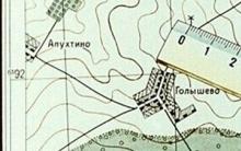


Orientation without a map
Yamal Peninsula (23 photos)
Yamal Peninsula (23 photos)
Map of Tver region Road map of Tver region detailed villages
Old topographic maps of the Tula province Old villages in the Tula region